Hiking trails of Gressoney
  • Choosing a trail
  • Hikes
    • Gressoney-Saint-Jean
    • Gressoney-La-Trinité
  • Trails
  • Refuges
    • Refuges description
    • Table of refuges
  • Weather
  • Lifts
  • Bus
  • Misc
    • Training for hiking
    • Tips for hikers
    • Information
    • Books on Gressoney
    • QR Codes
    • The Città di Mantova Refuge
    • Bivouacs of the past
    • The Castor tragedy of July 20, 1970
  • EN
    • IT
  • Click to open the search input field Click to open the search input field Search
  • Menu Menu
  • Link to Facebook
  • Link to Instagram
  • Link to Youtube
  • Description
  • Departure and arrival
  • The hike
  • GPX

Alta Luce/Hochliecht (3184m), trail 7C

from Stafal to Alta Luce/Hochliecht
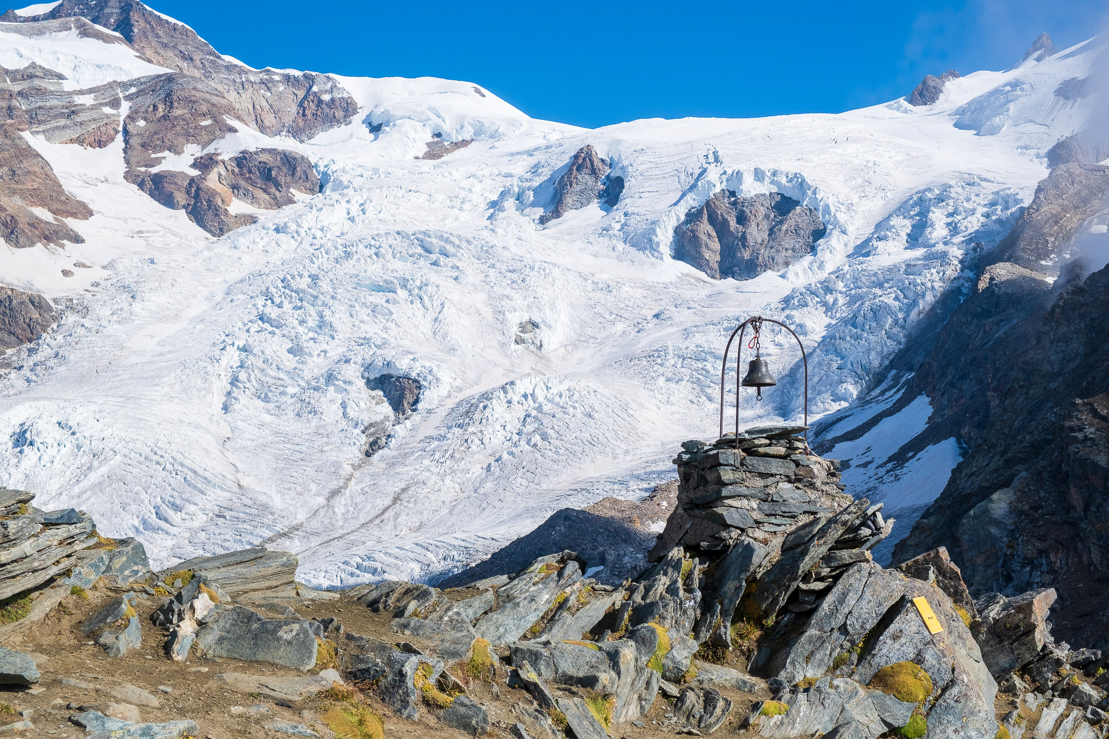
The Alta Luce bell

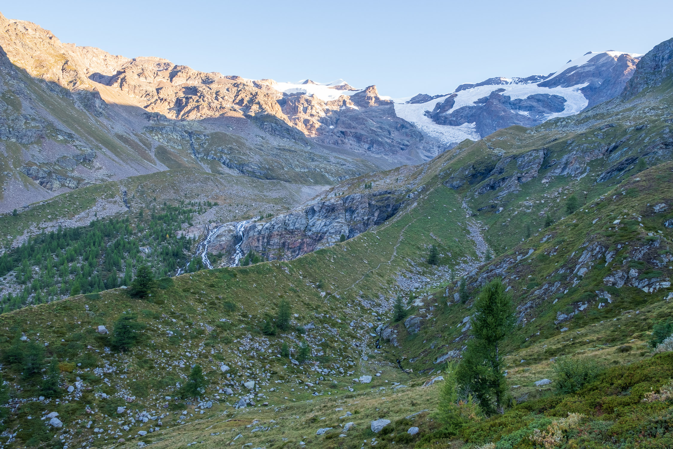
Trail 7C starts from Stafal (1840m) and goes to Alta Luce (3184m), also called Hochliecht. It is 6398m long and the total positive elevation gain is 1355m.
The approximate time for the ascent is 4h01. The trail is rated of difficulty E.
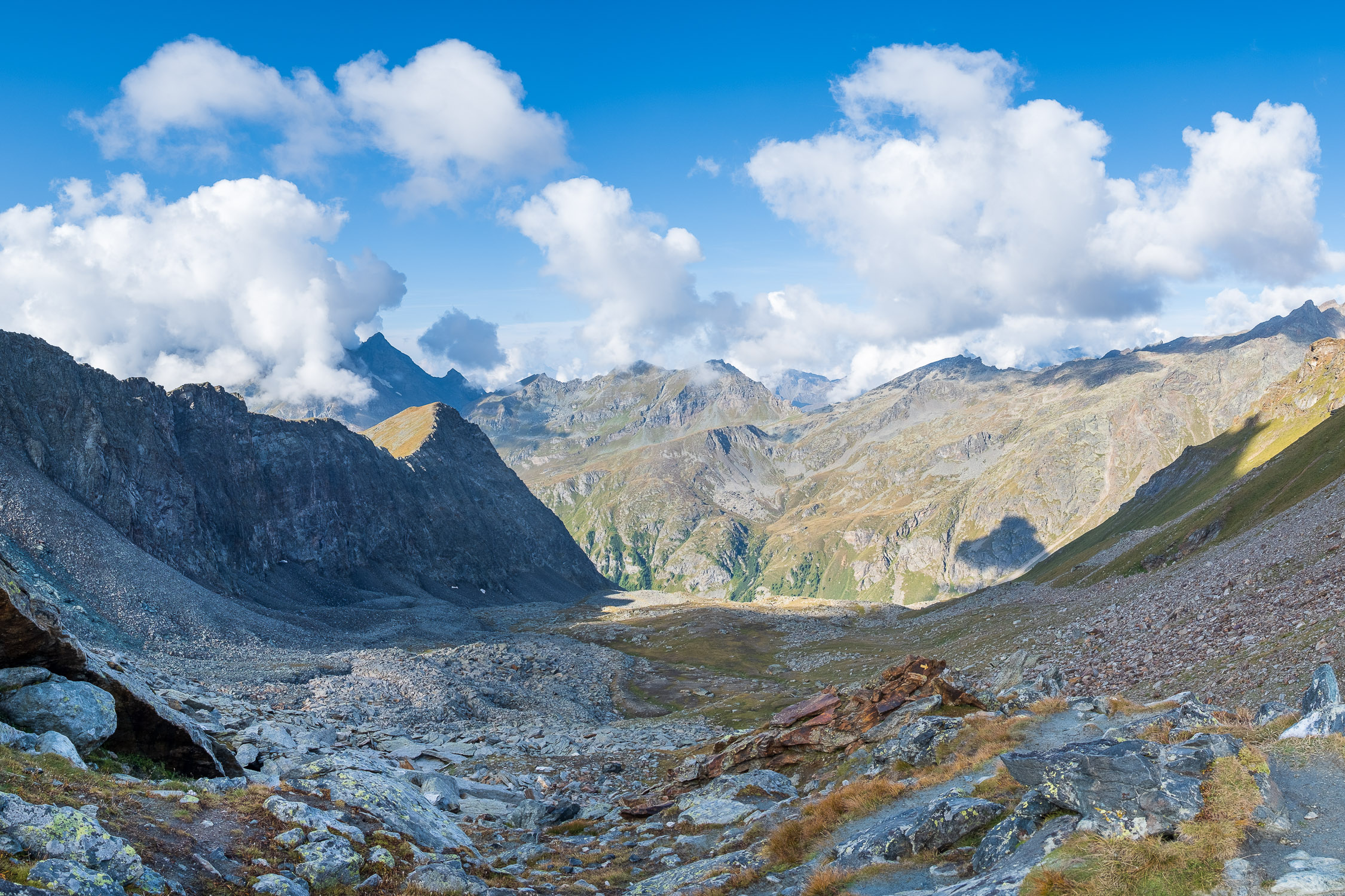
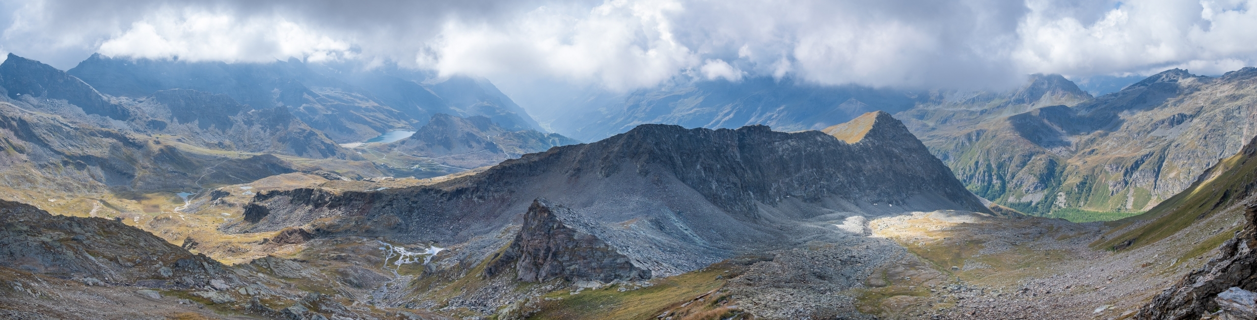
The Salza Hill

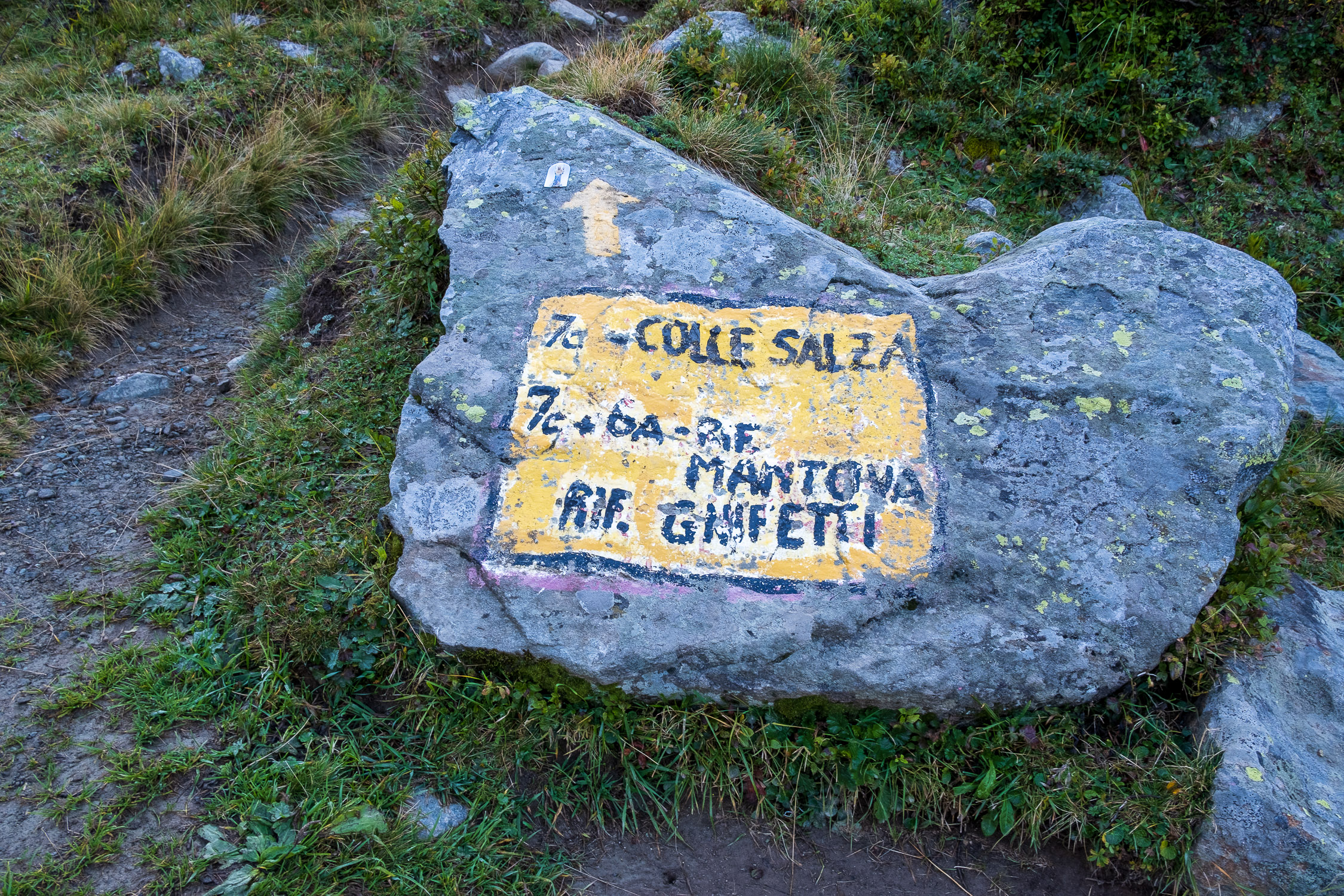
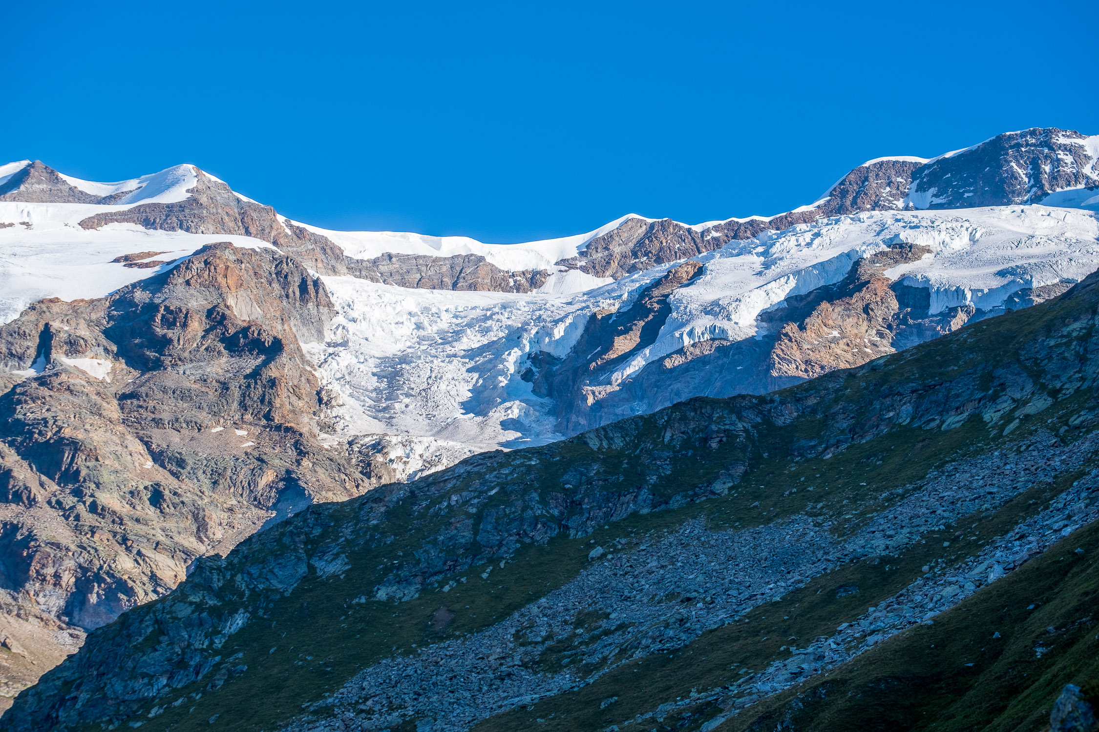
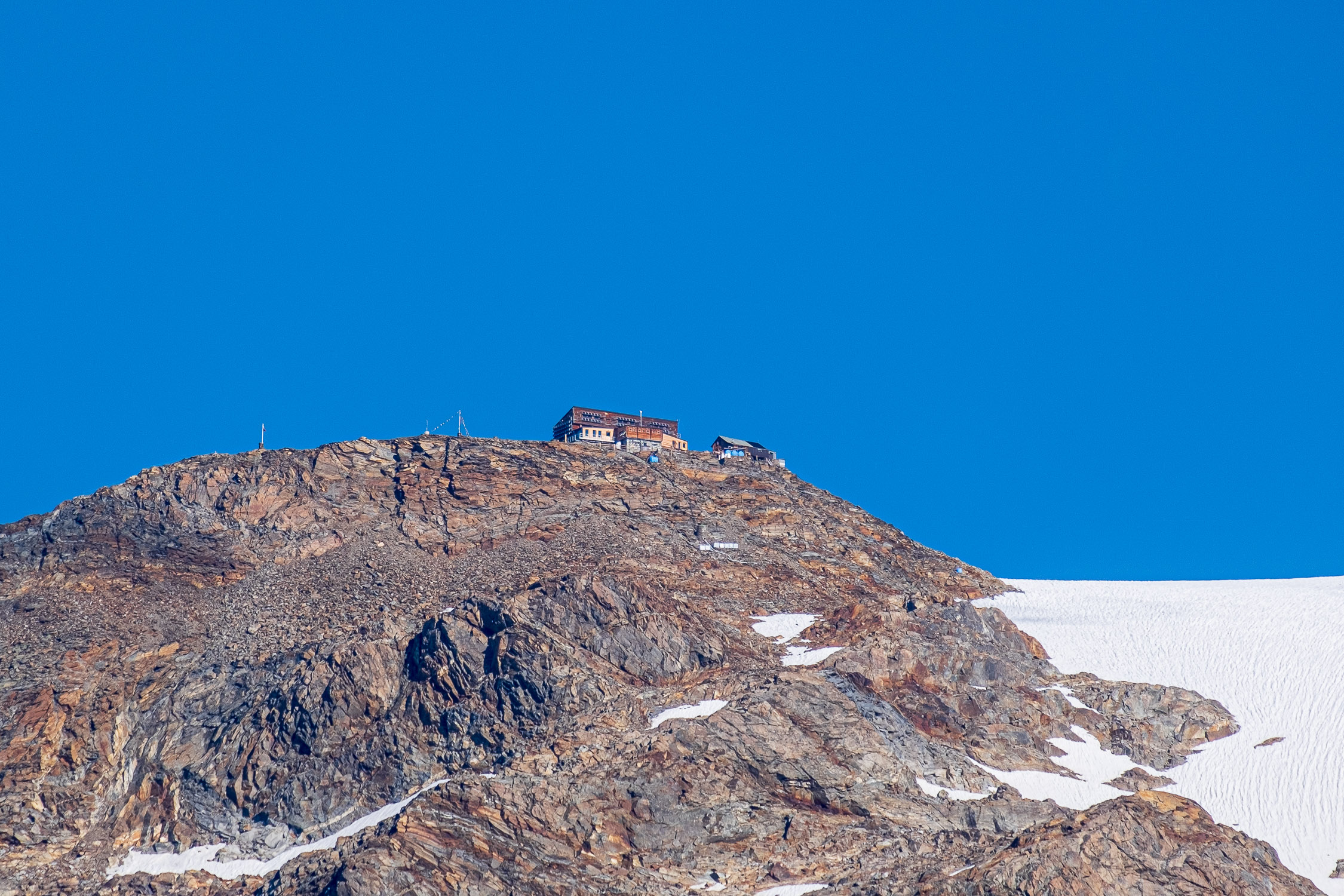
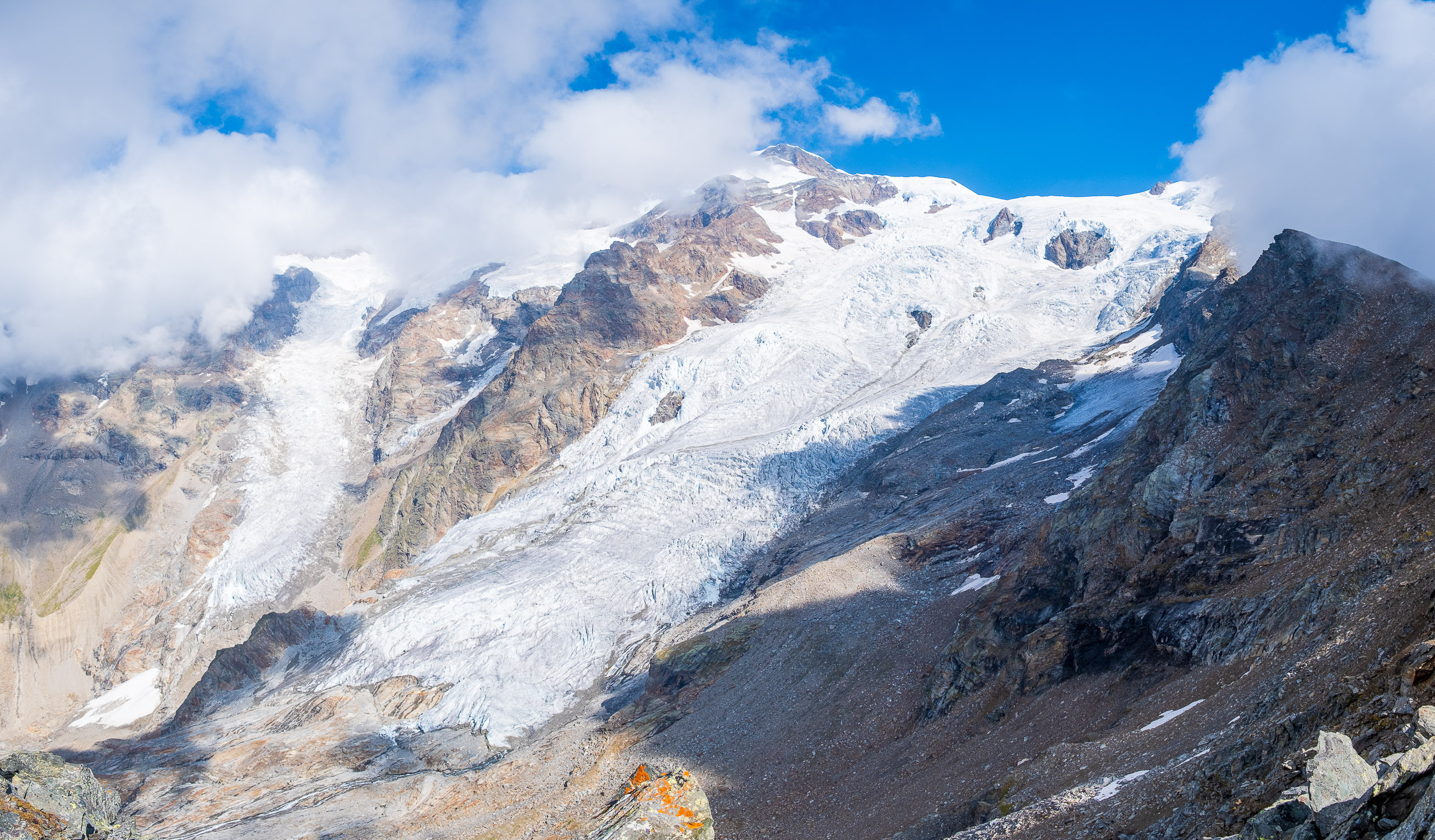
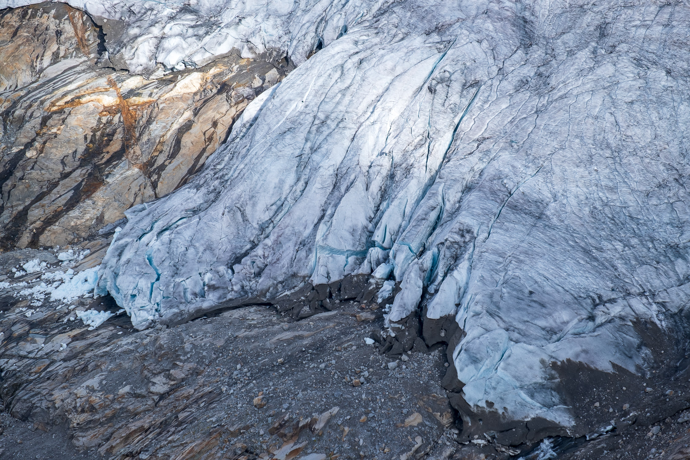
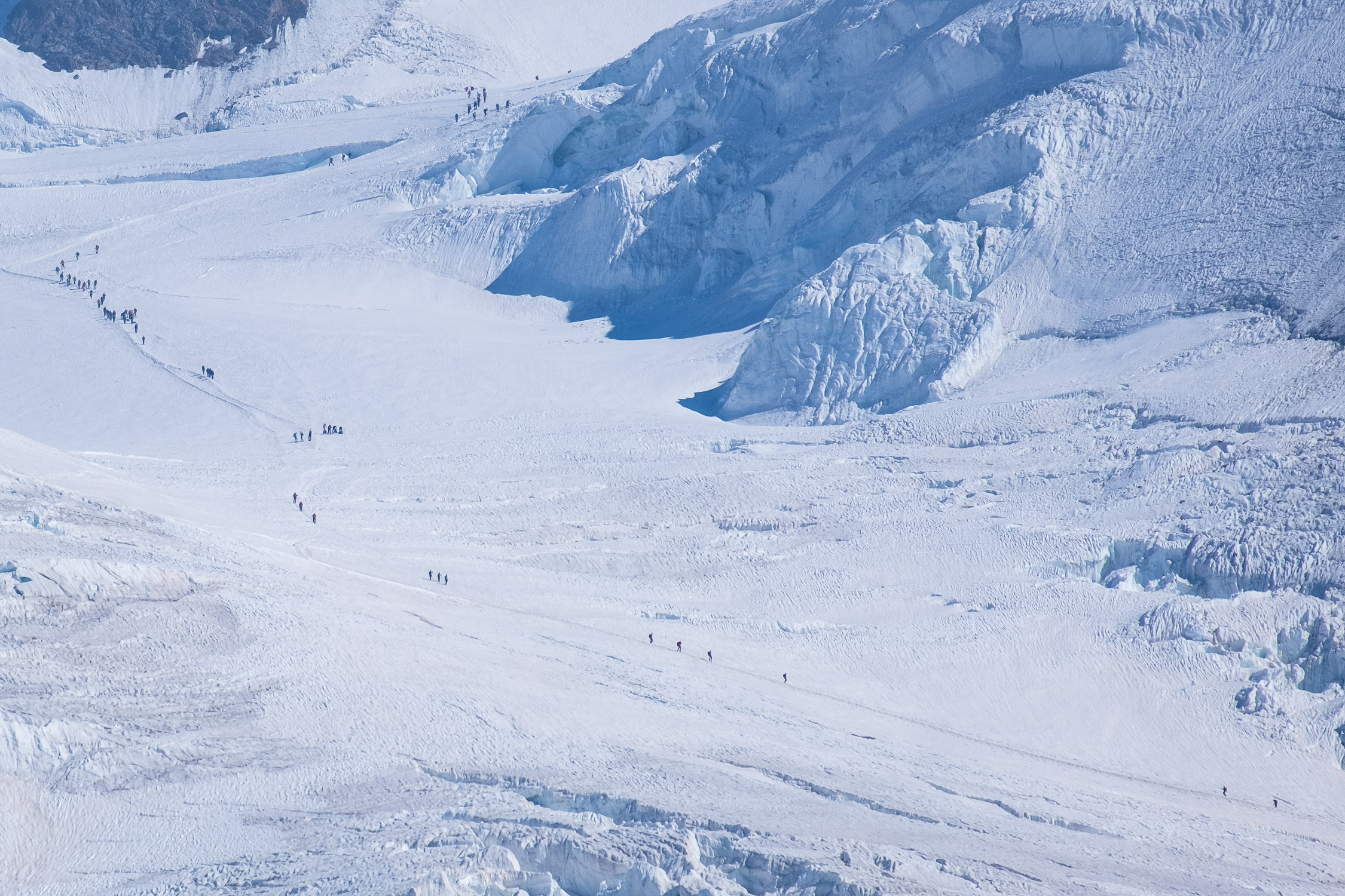
Long and beautiful route that starts from the valley floor, passes through the Salza Pass (2882m) and arrives on one of the most spectacular balconies around the Monte Rosa range. Alta Luce (it means “High Light”) stands on a spur that divides the Lys glacier from that of the Garstelet: on the same spur higher up is the refuge Città di Mantova and the Gnifetti Hut (from Alta Luce an unnumbered path rejoins the Trail 6A, which leads up to the Città di Mantova refuge)

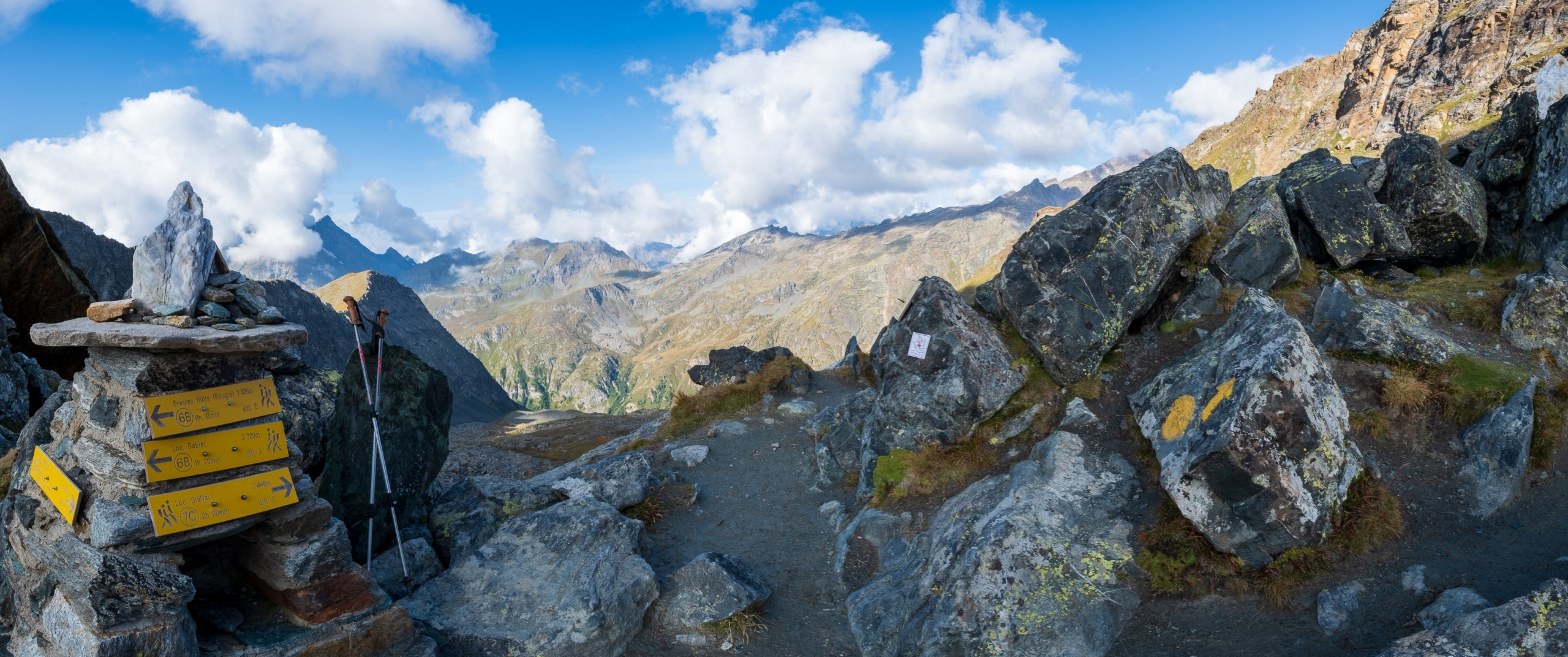
If you want to reduce the length of the walk, in Stafal instead of taking path 7 you take … the Gabiet cable car, which in less than 15 minutes takes you to Lake Gabiet, from which you simply take the trail 6B that one must follow (passing through the refuge Orestes Hütte) until it reaches the Salza Hill, a point from which one can continue to Alta luce by following the trail 7C described here.
If you want to avoid going through the refuge, you can take trail 6A from Gabiet, which for several sections is in common with 6B: past the refuge, 6A and 6B come together. As soon as you come to the next fork, where 6A separates from 6B going to the right, continue straight for 300 meters until you reach the Salza Pass.

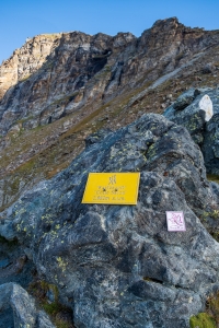
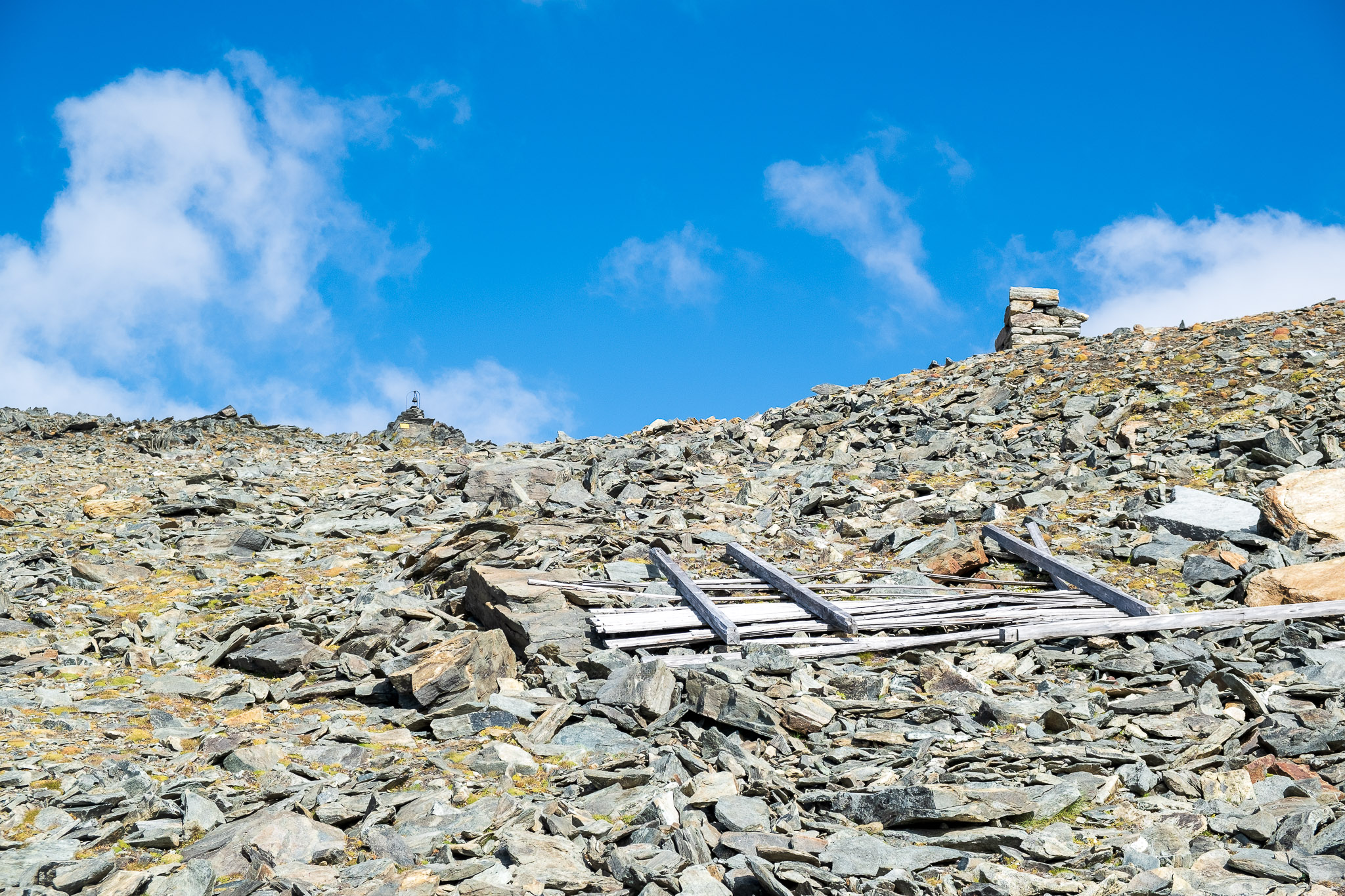
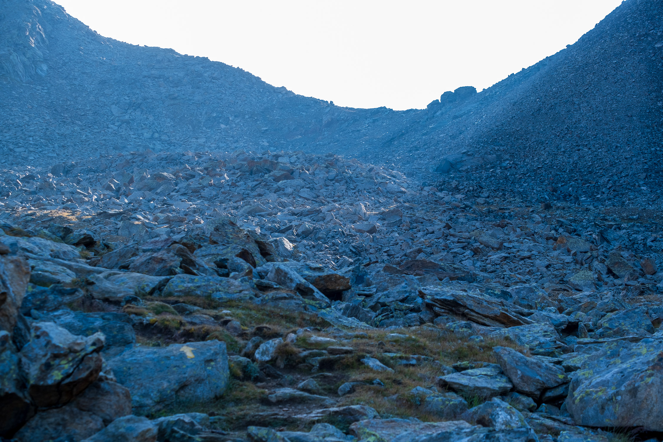
The trail presents no technical difficulty, and is excellently marked.

More information on level of difficulty, ascent times, maps and GPX tracks
Previous Previous Previous Next Next Next
123456789101112131415161718192021222324
Open image in lightbox: At the start, the 7/7C trail runs to the right of the Lys Open image in lightbox: At the start, the 7/7C trail runs to the right of the Lys
Open image in lightbox: Mountain huts near Cortlys Alp. Open image in lightbox: Mountain huts near Cortlys Alp.
Open image in lightbox: Sign indicating cheese for sale at Cortlys alp. Open image in lightbox: Sign indicating cheese for sale at Cortlys alp.
Open image in lightbox: Junction of trail 7 and trail 7C, theColle Salza is there at the top Open image in lightbox: Junction of trail 7 and trail 7C, theColle Salza is there at the top
Open image in lightbox: Directions to 7C, and possible continuation along 6A to the Città di Mantova Refuge Open image in lightbox: Directions to 7C, and possible continuation along 6A to the Città di Mantova Refuge
Open image in lightbox: On the left continues trail 7 to the headwaters of the Lys Open image in lightbox: On the left continues trail 7 to the headwaters of the Lys
Open image in lightbox: Stakeout hunters Open image in lightbox: Stakeout hunters
Open image in lightbox: The 4,000 is getting closer and closer Open image in lightbox: The 4,000 is getting closer and closer
Open image in lightbox: Some perfectly camouflaged ibexes Open image in lightbox: Some perfectly camouflaged ibexes
Open image in lightbox: The Quintino Sella Refuge Open image in lightbox: The Quintino Sella Refuge
Open image in lightbox: Salza Hill is approaching Open image in lightbox: Salza Hill is approaching
Open image in lightbox: The sun reaches the Salza valley Open image in lightbox: The sun reaches the Salza valley
Open image in lightbox: From the Salza Pass toward the valley we have just traveled, over there is Stafal Open image in lightbox: From the Salza Pass toward the valley we have just traveled, over there is Stafal
Open image in lightbox: The Salza Hill Open image in lightbox: The Salza Hill
Open image in lightbox: From the Salza Hill looking toward the Alta Luce Open image in lightbox: From the Salza Hill looking toward the Alta Luce
Open image in lightbox: From the Salza Pass, the path to the Alta Luce Open image in lightbox: From the Salza Pass, the path to the Alta Luce
Open image in lightbox: Ascending to Alta Luce Open image in lightbox: Ascending to Alta Luce
Open image in lightbox: The remains next to the Passera Bivouac Open image in lightbox: The remains next to the Passera Bivouac
Open image in lightbox: The Alta Luce bell Open image in lightbox: The Alta Luce bell
Open image in lightbox: From Alta luce the Lys Glacier, East Lyskamm and Lyskamm Nose. Open image in lightbox: From Alta luce the Lys Glacier, East Lyskamm and Lyskamm Nose.
Open image in lightbox: Zoom in on the terminal tongue of the Lys Glacier Open image in lightbox: Zoom in on the terminal tongue of the Lys Glacier
Open image in lightbox: Ropes returning to the Gnifetti Hut. Open image in lightbox: Ropes returning to the Gnifetti Hut.
Open image in lightbox: Descending from Alta Luce: Salza Hill at the base of the pyramid in the foreground, Punta Telcio to the right of the ridge in the background Open image in lightbox: Descending from Alta Luce: Salza Hill at the base of the pyramid in the foreground, Punta Telcio to the right of the ridge in the background

1. Start and finish

Trail 7C starts from Stafal, the elevation is 1840m.
See on Google Maps.

Latitudine e longitudine (WGS84 - EPSG 4326): 45.8598466868, 7.81251405414

The arrival location is Alta Luce. The altitude is 3184m.
See on Google Maps.

Latitudine e longitudine (WGS84 - EPSG 4326): 45.8833547961, 7.83512040653

2. The route

As soon as you park your car in the giant parking lot in Stafal, continue until you reach the bridge over the Lys at the end of the paved road and take the dirt road to the right: you will soon encounter the marker for the Trail 7, which leads to the headwaters of the Lys, trail that for the initial stretch is in common with our 7C trail.

At the start, the trail is to the right of the Lys

At the start, the trail is to the right of the Lys

The marked path follows the course of the Lys River on the right, gently gaining altitude. You soon come to a plateau, heralded by a couple of buildings that can be seen from the trail, where the wonderful Alpe Cortlys(1993m) is located. If the sign is displayed you can stop to buy cheese and butter (follow the signs, the hut where the cheese is for sale is a very short distance to the left of the sign).

Sign indicating cheese for sale at Cortlys alp.

Sign indicating cheese for sale at Cortlys alp.

The junction between Trail 7 and 7C is located at 2165 meters, near the lower edge of the left moraine of the Lys.

Junction of Trail 7 and Trail 7C: Salza Hill is up there

Junction of Trail 7 and Trail 7C: Salza Hill is up there

Leave Trail 7, which continues to the springs, and take Trail 7C, which ascends the long Salza valley, oriented eastward and closed to the south by the rocky wall of Punta Telcio (2833m, reached via Trail 7B). You pass the remains of the Alpe Salza Inferiore at 2323 meters, while as you climb the view of the Rosa mountain range becomes wider and wider. The trail continues to climb, passing short shelves, until it reaches the Salza Pass at 2882 meters (about 3 hours so far from Stafal). The last ramp before the pass is quite steep and slippery; it is definitely the most technically challenging point of the entire trail.

The Salza Hill

The Salza Hill

There are several options from the Salza pass: you can descend to the Orestes Hutte via trail 6B (and from there return to the Gabiet shelf), or you can continue until you meet trail 6A, which leads to the Città di Mantova hut (and from there to the Gnifetti Hut). We continue along trail 7C, which climbs along the north ridge from the Salza Pass, at first quite steep and over rather slippery scree, then gentler but still on the “merry andante.” The trail ascends into a small stony valley next to the ridge, then continues in wide turns, still on decidedly stony terrain…

Ascending to the Alta Luce

Ascending to the Alta Luce

…until passing by the remains of two buildings. The lower ones are from Passera Bivouac (3170m),destroyed by a blizzard in 1983 and never rebuilt: you will find more information on this page.

Remains of the Passera bivouac

Remains of the Passera bivouac

The remains just above are instead what remains of a hunting lodge belonging to Baron Peccoz, The lodge is visible in this photo from 1894 when itwas visited by Queen Margherita with her retinue (photo taken from Matterhorn and Monte Rosa, by Alessandro Gogna and Marco Milani, 2007):

Queen Margaret at the Peccoz hut, 1894

Queen Margaret at the Peccoz hut, 1894

The bell marking the arrival at the summit is now very close, as is one of the most spectacular viewpoints in the entire Gressoney valley.

The summit bell of the Alta Luce

The summit bell of the Alta Luce

3. The GPX track

This is the map of the trail, according to the SCT Trail Cadastre of the Aosta Valley.

Download the trail in GPX format

4. A recent hike

12/09/2021

I started from Stafal along the 7/7C trail, climbed the Salza valley, reached the Salza pass and from there the Alta Luce. I then descended by trail 6A to the junction with trail 7B, climbed to Blue Lake and from there to
Punta Telcio
. I then descended back to Blue Lake, returned to Gabiet, and from Gabiet returned to Stafal by descending Trail 7A. A nice gallop, graced by wonderful weather: starting very early, I managed to get to Alta Luce before several clouds thickened over Rosa, thus managing to take some nice pictures.

Note that shortly after taking 7C, at the beginning of the Salza valley I encountered a group of hunters stationed like cougars pointing at a distant chamois. I was lent the binoculars to see it, but I absolutely could not distinguish it, camouflaged as it was in the slope. I walked away hoping never to hear the gunshot, which fortunately never came.

Halfway up the Salza valley I passed a large group of ibex. No other animals spotted during the day.

Share this page
  • Share on Facebook
  • Share on X
  • Share on LinkedIn
  • Share by Mail
2022 - Gressoney Hikes - info@gressoneyhikes.com - privacy policy - sitemap
Link to: Punta Telcio (2833m), trail 7B Link to: Punta Telcio (2833m), trail 7B Punta Telcio (2833m), trail 7B Link to: Bettaforca Pass (2673m), trail 8 Link to: Bettaforca Pass (2673m), trail 8 Ibexes in BettaforcaBettaforca Pass (2673m), trail 8
Scroll to top Scroll to top Scroll to top

This site uses cookies to ensure functionality and improve the user experience. You can accept with "Accept", decline with "Decline" or deny consent to certain cookies in "Settings". For more information, see the privacy policy


AcceptDeclineSettings

Cookie and Privacy Settings


How we use cookies

We may request cookies to be set on your device. We use cookies to let us know when you visit our websites, how you interact with us, to enrich your user experience, and to customize your relationship with our website.

Click on the different category headings to find out more. You can also change some of your preferences. Note that blocking some types of cookies may impact your experience on our websites and the services we are able to offer.

Essential Website Cookies

These cookies are strictly necessary to provide you with services available through our website and to use some of its features.

Because these cookies are strictly necessary to deliver the website, refusing them will have impact how our site functions. You always can block or delete cookies by changing your browser settings and force blocking all cookies on this website. But this will always prompt you to accept/refuse cookies when revisiting our site.

We fully respect if you want to refuse cookies but to avoid asking you again and again kindly allow us to store a cookie for that. You are free to opt out any time or opt in for other cookies to get a better experience. If you refuse cookies we will remove all set cookies in our domain.

We provide you with a list of stored cookies on your computer in our domain so you can check what we stored. Due to security reasons we are not able to show or modify cookies from other domains. You can check these in your browser security settings.

Google Analytics Cookies

These cookies collect information that is used either in aggregate form to help us understand how our website is being used or how effective our marketing campaigns are, or to help us customize our website and application for you in order to enhance your experience.

If you do not want that we track your visit to our site you can disable tracking in your browser here:

Other external services

We also use different external services like Google Webfonts, Google Maps, and external Video providers. Since these providers may collect personal data like your IP address we allow you to block them here. Please be aware that this might heavily reduce the functionality and appearance of our site. Changes will take effect once you reload the page.

Google Webfont Settings:

Google Map Settings:

Google reCaptcha Settings:

Vimeo and Youtube video embeds:

Other cookies

The following cookies are also needed - You can choose if you want to allow them:

Privacy Policy

You can read about our cookies and privacy settings in detail on our Privacy Policy Page.

AcceptDecline
Open Message Bar Open Message Bar Open Message Bar