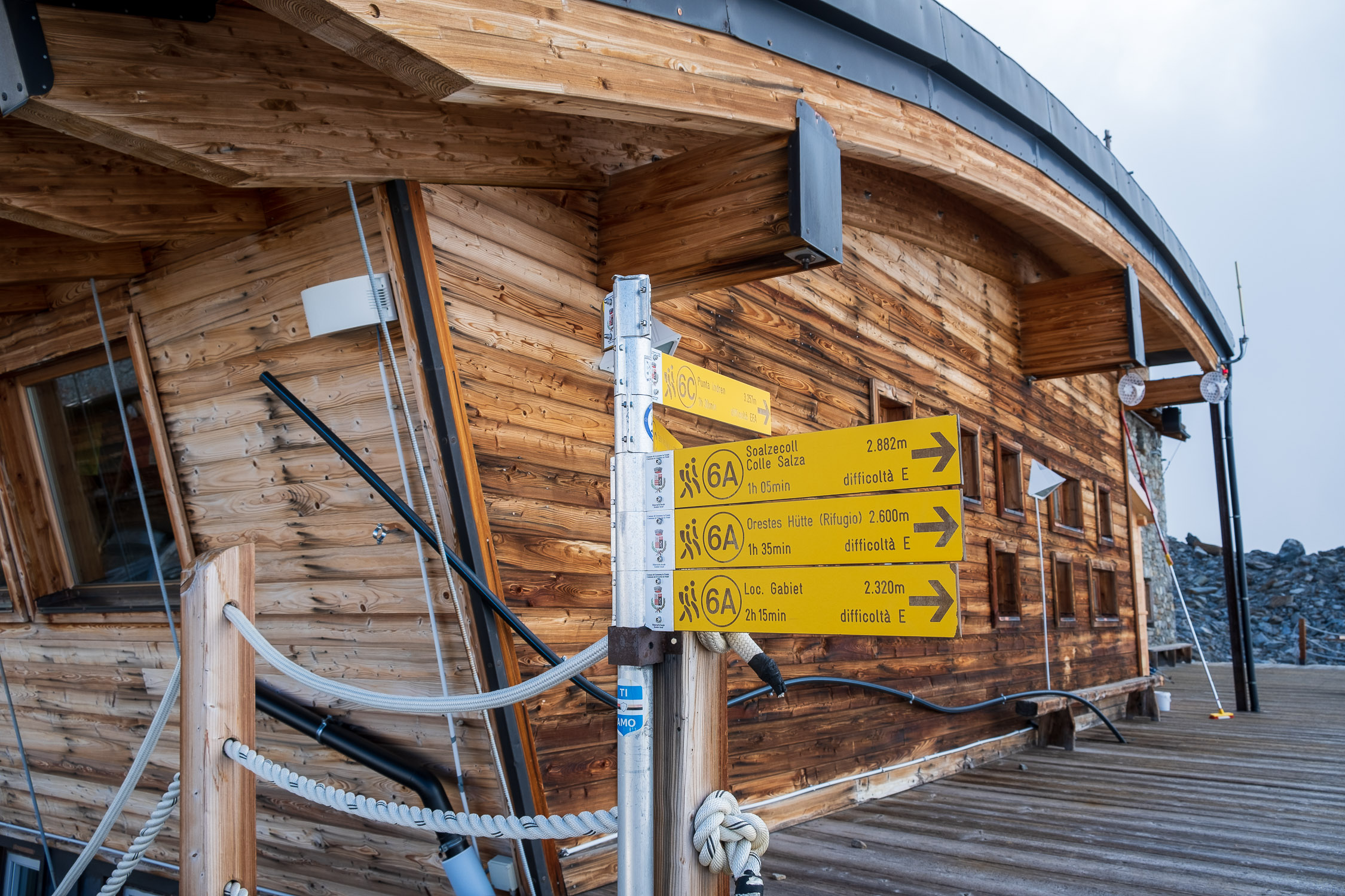
Mantova (3455m) and Gnifetti (3647m) refuges, trail 6A
from the Adler’s Nest to the Mantua Shelter
(you can continue to the Capanna Giovanni Gnifetti hut).

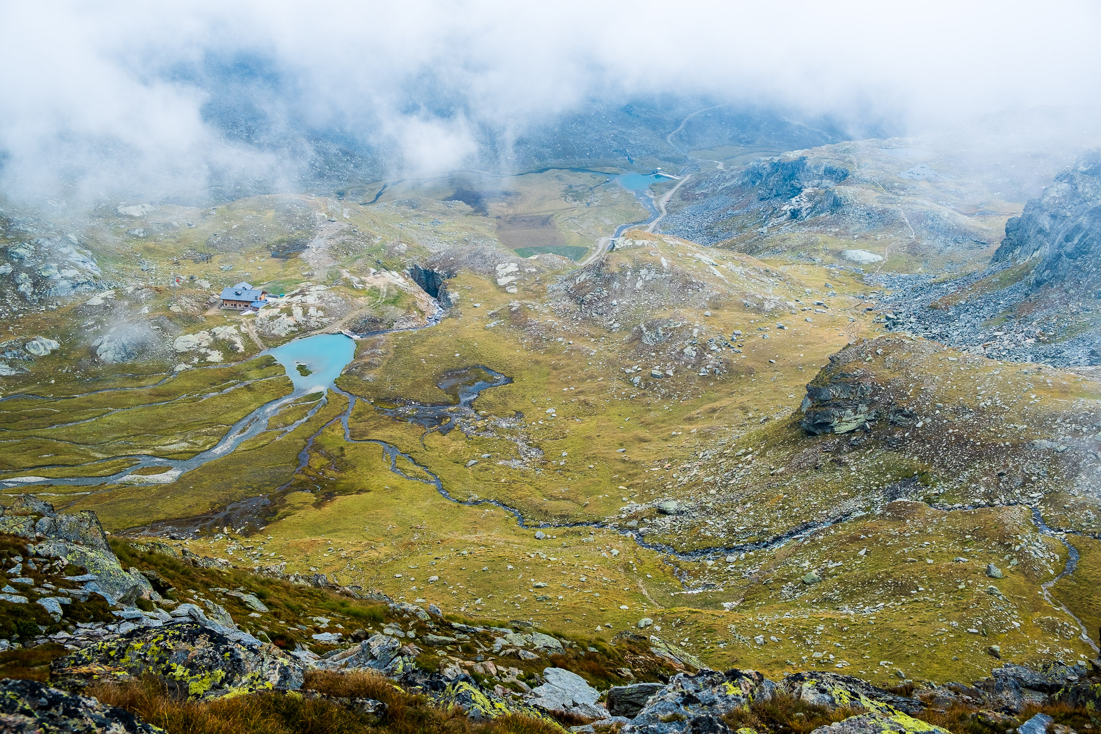
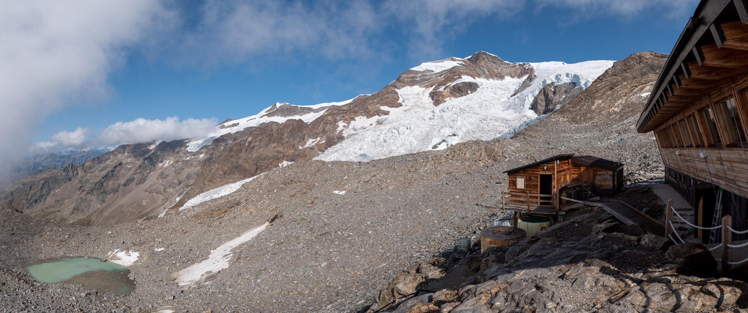
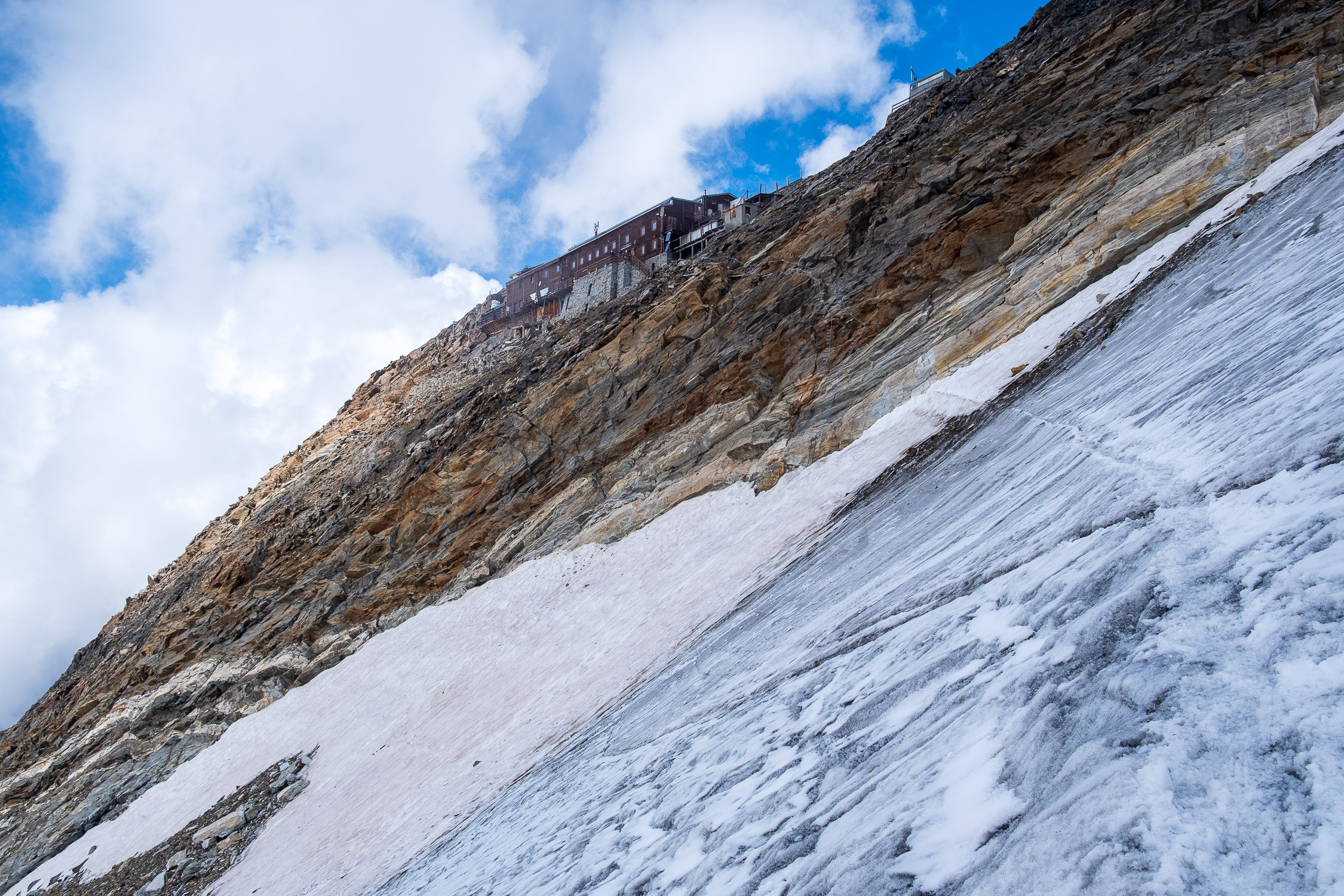
The Mantua Refuge
Trail 6A starts from the Adler’s Nest hut and arrives at the City of Mantua hut (3455m). It is 6369m long and the total positive elevation gain is 1094m.
The approximate time for the climb is 3h24. The trail is rated EE difficulty.
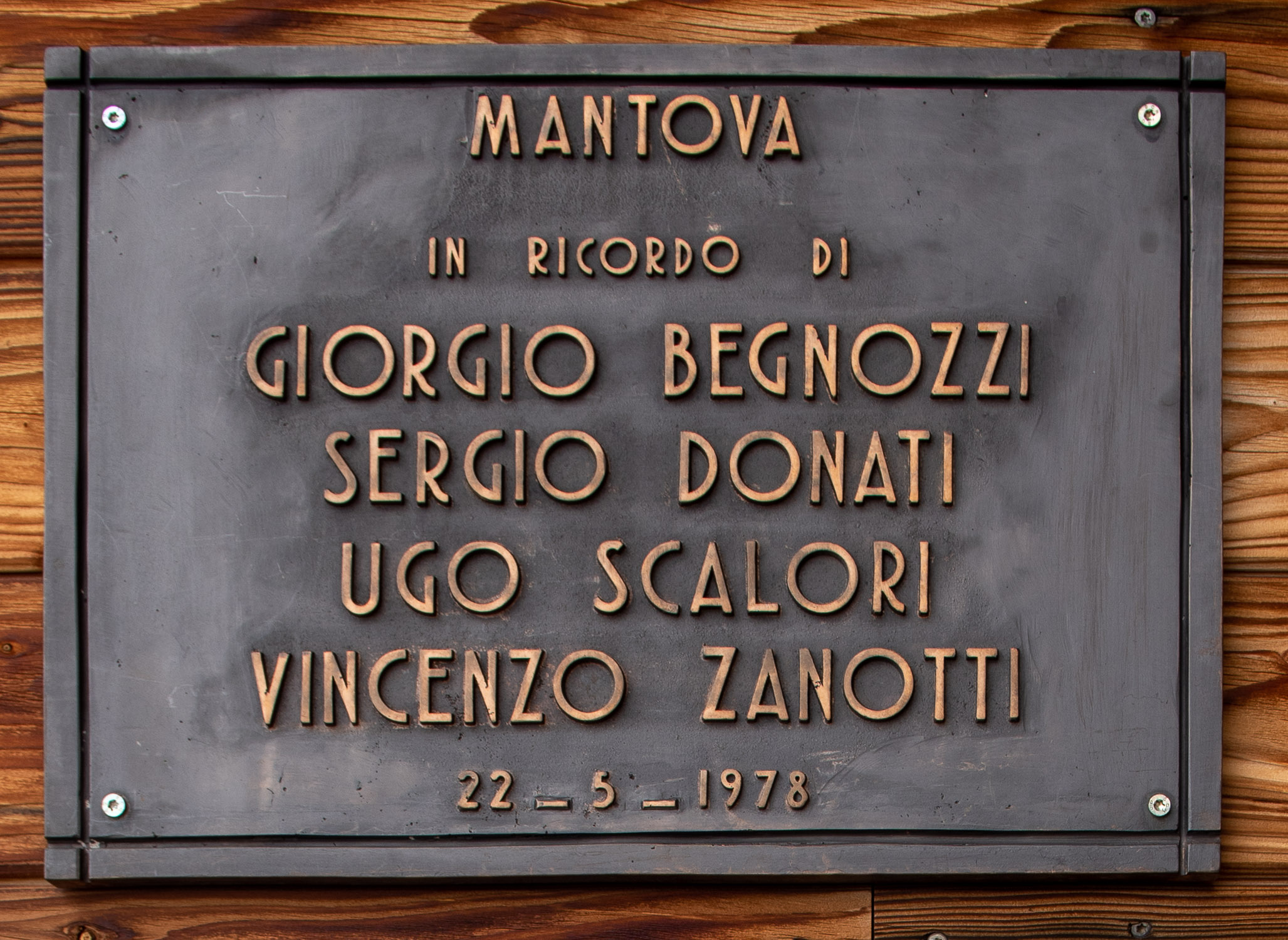
The Rifugio Città di Mantova (official website), opened in 1984, ties its birth to a tragic event: in May 1978 four Mountaineers from Mantua died near the nose of the Lyskamm, swept away by an avalanche. The families of the victims donated a sum of money to the Gressoney guides to thank them for the tremendous work done during the rescue operations.The guides came up with the idea of using this sum to build a shelter, and thanks to the contributions of several other entities, in September 1984 the City of Mantua shelter was finally opened. On this page I have listed some period articles recounting the tragedy and the days of the inauguration, for those interested in learning more.

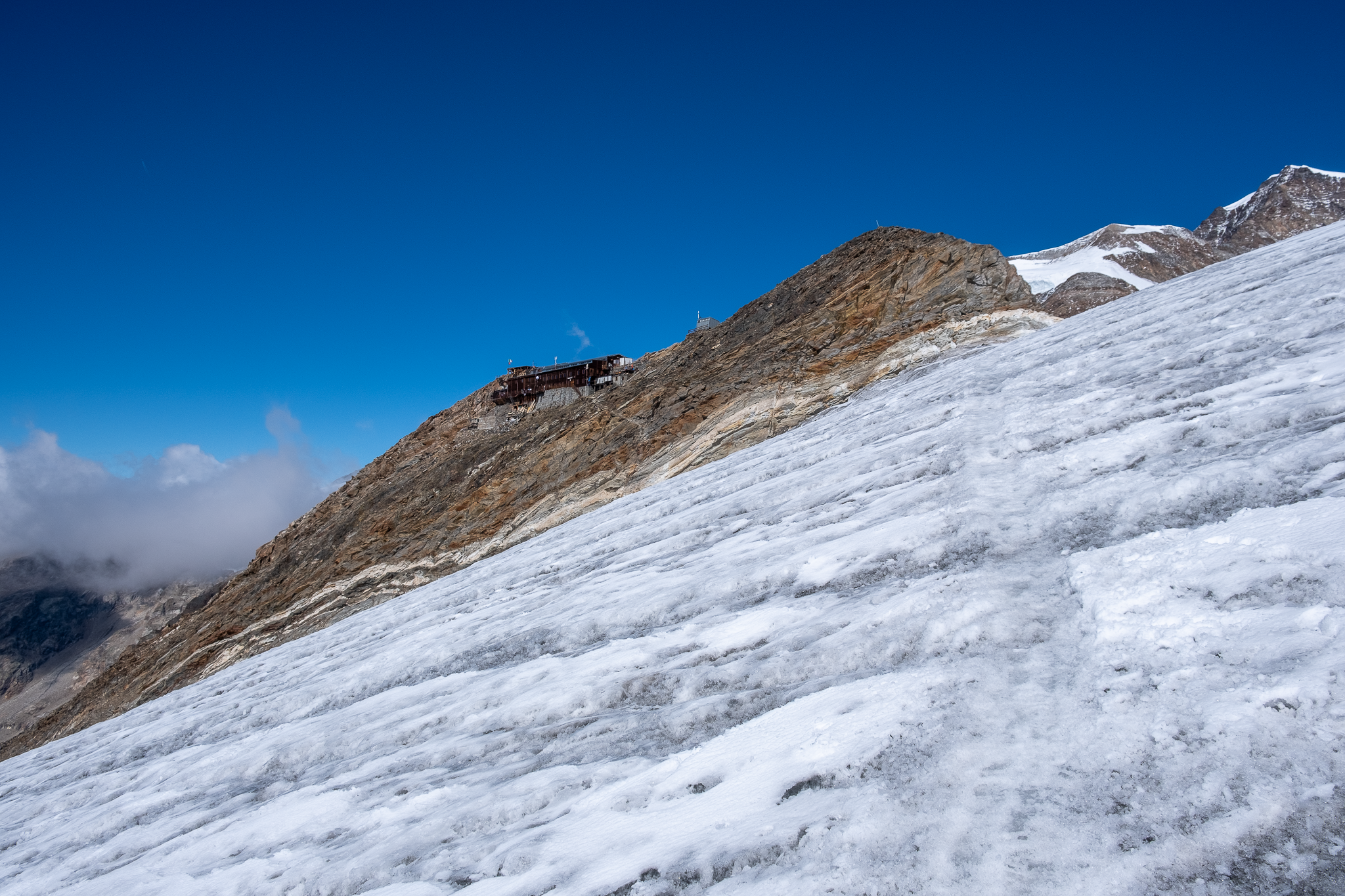
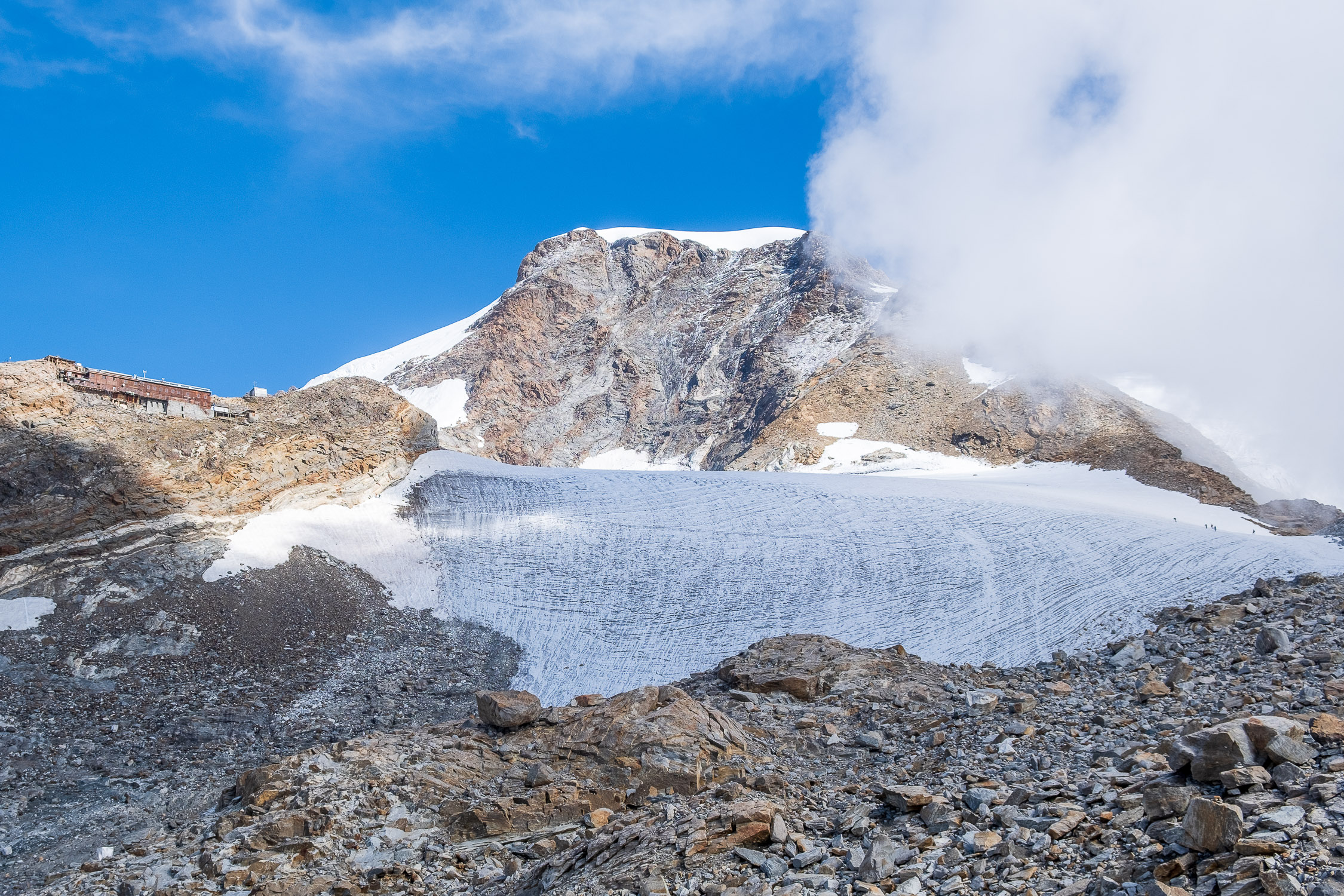
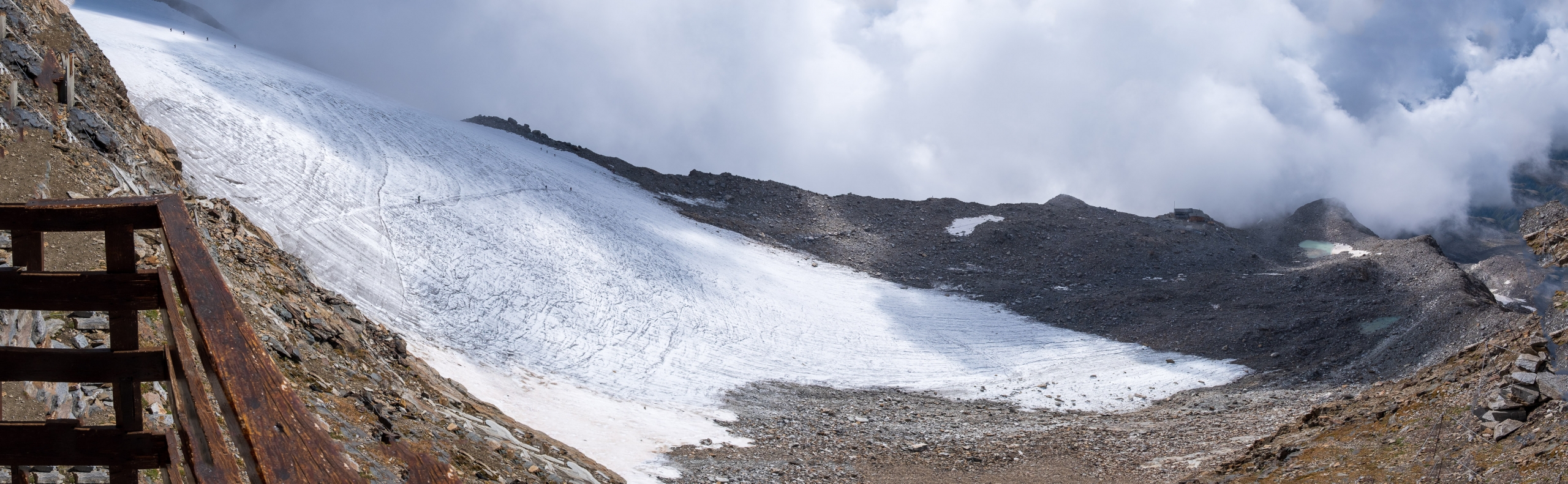
The crossing of the Garstelet glacier.
The shelter was expanded in 2007.
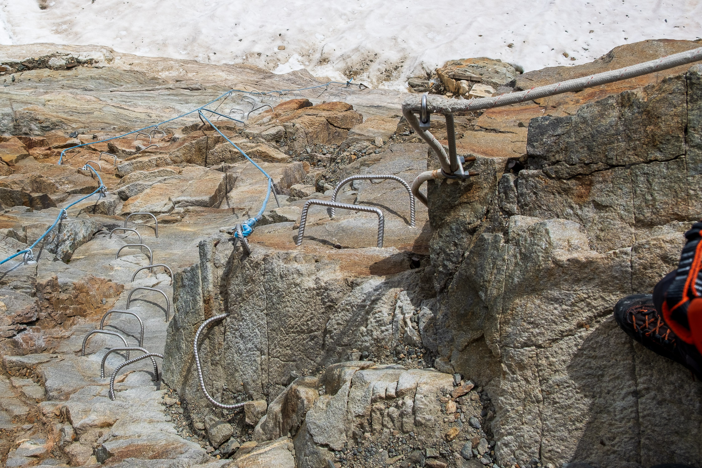
A short distance from the Città di Mantova refuge is the capanna Giovanni Gnifetti refuge (official website), 3647m . This page describes the short but technically challenging route to reach it: it is in fact necessary to cross the Garstelet glacier, so you need to know how to use crampons and ice axe on ice.

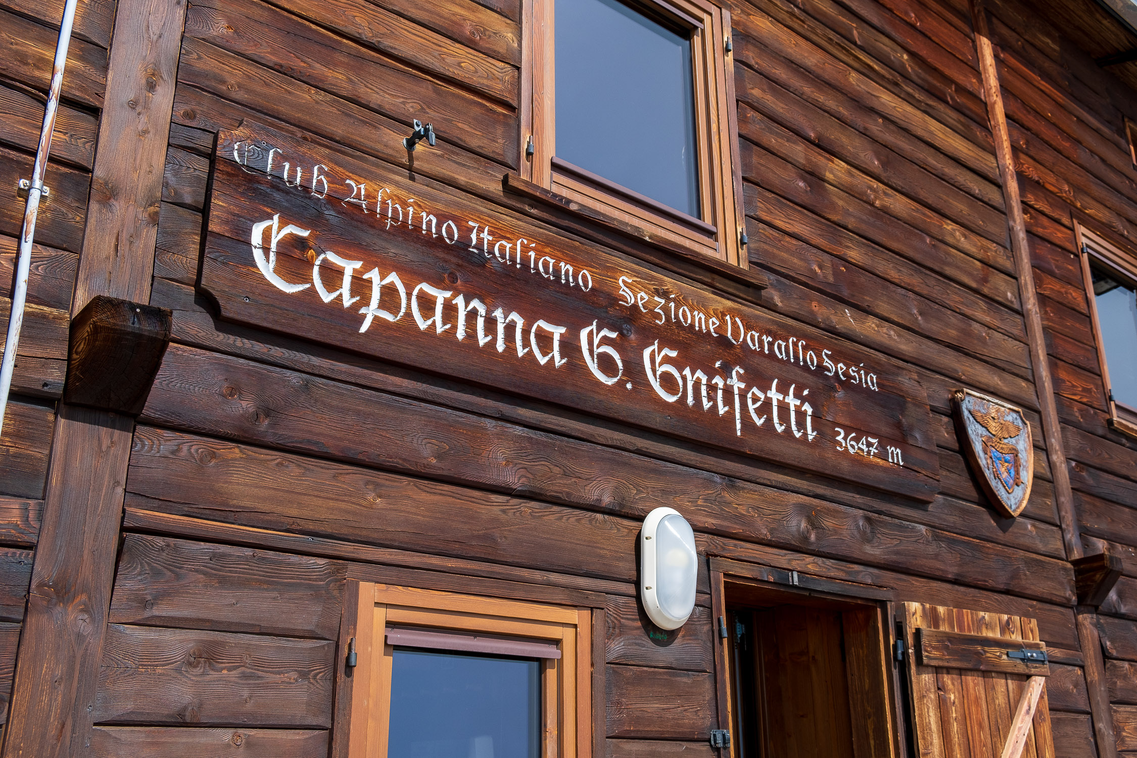
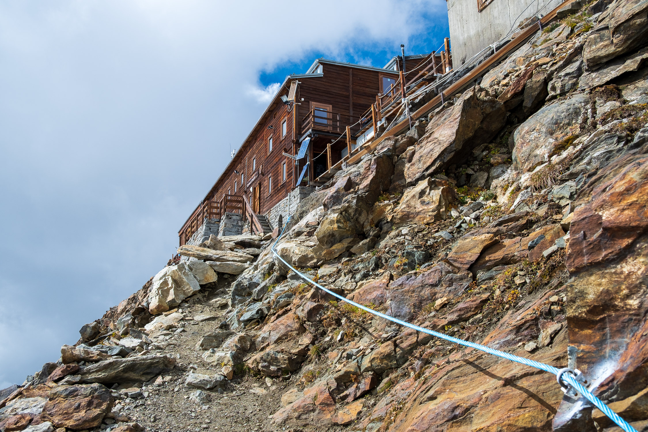
The Gnifetti Hut
The “Gnifetti Hut,” as it is commonly called, stands on the site where a small bivouac was built in 1876: enlarged several times in the following years, in 1967 (on the occasion of the centenary of the founding of the CAI section of Varallo) it was completely rebuilt, and the result is the hut we can admire today, which overlooks a steep rock face behind the Garstelet glacier.
Up to the Mantua refuge the route, classified as EE, is long but not technically challenging. Up to the Salza Pass we climb along the route shared by trails 7B (Blue Lake, Punta Telcio) and 6B (Orestes Hutte, Salza Pass). Unlike 6B, 6A does not reach the Salza Pass but veers northeast when there are only a few hundred meters to go. Only the very last section on the rocks leading to the hut requires attention, as it is necessary in some passages to lean on your hands.
From Mantua to Gnifetti, on the other hand, the route (the trail has no waymarks) is EEA: crampons and ice axe absolutely necessary to cross the glacier, which (although short) should never be underestimated.
Mantua and Gnifetti are the bases from which all expeditions to the “eastern” destinations of the Rosa chain depart(Punta Gnifetti/Capanna Margherita, Punta Dufour, Pyramide Vincent, Punta Parrot, Punta Zumstein, Corno Nero, Lyskamm traverse…).


