Bettaforca Pass (2673m), trail 8

from Stafal to Colle Bettaforca

Ibexes at the Bettaforca pass

Ibexes at the Bettaforca pass

Trail 8 starts from Stafal and arrives at the Bettaforca Pass (2673m). It is 5400m long and the total positive elevation gain is 855m.
The approximate time for the ascent is 2h37. The trail is rated T difficulty.

After reaching the plateau of Sant’Anna (2180m), the trail runs along the route of the Sant’Anna-Bettaforca chairlift. One can, of course, save some walking and get to St. Anna via the Stafal-Sant’Anna cable car, and then continue along the final stretch on foot. Or, vice versa, do only the first section on foot, and go up to Bettaforca Hill via chairlift.

Puppy at the Bettaforca hill

Puppy at the Bettaforca hill

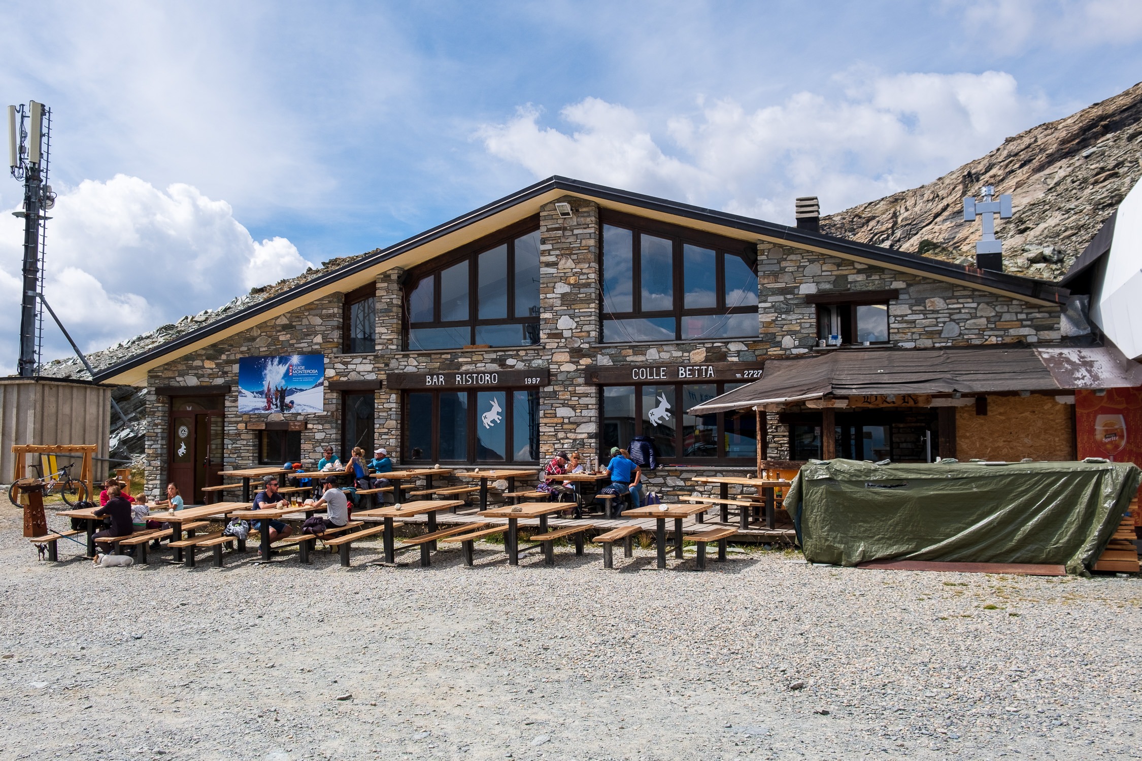
A long and easy trail, it has as an added attraction the fact that it passes by three shelters/restaurants: the Jutz Restaurant arrived at St. Anna, the Sitten Refuge (it is possible to stay overnight there) just above, and the Colle Betta Refuge at the end of the trail. Behind the Colle Betta Ristoro it is very easy to find groups of ibex, accustomed to human presence, who let themselves get close enough to be photographed quietly.

Less than five minutes from the start, the trail passes right next to a little-known gem of the past due to its secluded location: the Oagre Chapel, which dates back to 1776 and is dedicated to the worship of Our Lady of the Snows. As the sign on the site reads,“This is a place much loved by the people of Gressoney, because here once upon a time, on a cold winter morning, the image of Our Lady appeared in the ice of the fountain.”

St. Anne’s is also home to the well-known St. Anne’s Chapel, which stands on a large grassy clearing overlooking La Trinité.

From the Bettaforca Pass passes Trail 9, which leads to the Quintino Sella Refuge, the starting point for the main western 4000-meter peaks of the Rosa range.

1. Start and finish

Trail 8 starts from Stafal, the elevation is 1841m.
See on Google Maps.

Latitudine e longitudine (WGS84 - EPSG 4326): 45.8598466868, 7.81251405414

The arrival location is Colle Bettaforca. The altitude is 2673m.
See on Google Maps.

Latitudine e longitudine (WGS84 - EPSG 4326): 45.8685533539, 7.781187967

2. The route

Leaving the car in the giant parking lot in Stafal, we drive up the road to the bridge over the Lys. Take the left side of the river (orographic right) on the dirt road that passes by the houses. A little further on you will find the yellow marker for Trail 8. Soon you will catch a glimpse of the wonderful Oagre Chapel, well hidden by all the recent construction.

Oagre chapel dedicated to Our Lady of the Snows

Oagre chapel dedicated to Our Lady of the Snows

The path climbs to its left with a very small slope, passes for a few stretches next to the ski slope, finally arrives on the plateau of St. Anne’s (2180m), where the arrival station of the stafal-Sant’anna cable car. I certainly recommend taking a short detour to the famous chapel of St. Anne, which is located a short distance away by continuing along the road away from the cable car station.

St. Anne's Chapel

St. Anne’s Chapel

Next to the cable car arrival station is the Bar Restaurant Jutz

Jutz restaurant and the road going up to Sitten

Jutz restaurant and the road going up to Sitten

…from which passes the dirt road that goes up to theAlbergo Ristoro Sitten

The Hotel Rifugio Sitten

The Hotel Rifugio Sitten

…and then continues skirting the chairlift route to the finish, at Bettaforca Pass (2673m), where the Colle Betta Refreshment House is located.

Bar Ristoro Colle Betta

Bar Ristoro Colle Betta

Behind the Colle Betta refreshment stand, descending slightly, or climbing a few meters up the slope behind, one can overlook the Val D’Ayas, finding the arrival station of the chairlift leading to the pass from the opposite side. Lo and behold, in this area in summer it is very common to find small groups of ibex, which are used to human presence and therefore allow themselves to be approached (certainly not touched, but certainly photographing them is very easy).

Baby ibex in Bettaforca

Baby ibex in Bettaforca

From the Bettaforca Pass it is possible to continue to the Quintino Sella Refuge along Trail 9: the marker post is to the right of the chairlift station.

3. The GPX track

This is the map of the trail, according to the SCT Trail Cadastre of the Aosta Valley.

4. A recent hike

6/2/2021

I walked this path during the lockdown winter of 2021. Actually from the Sitten hut onward I climbed directly up the Bettaforca slope, thanks to the crampons. Nothing to report: the day was very overcast, with reddish clouds due to the arrival of Sahara sand carried by area currents.