Col D’Olen (2881m), trail 6

from Orsia to Col D’Olen

Angelo Mosso Scientific Institute

Angelo Mosso Scientific Institute

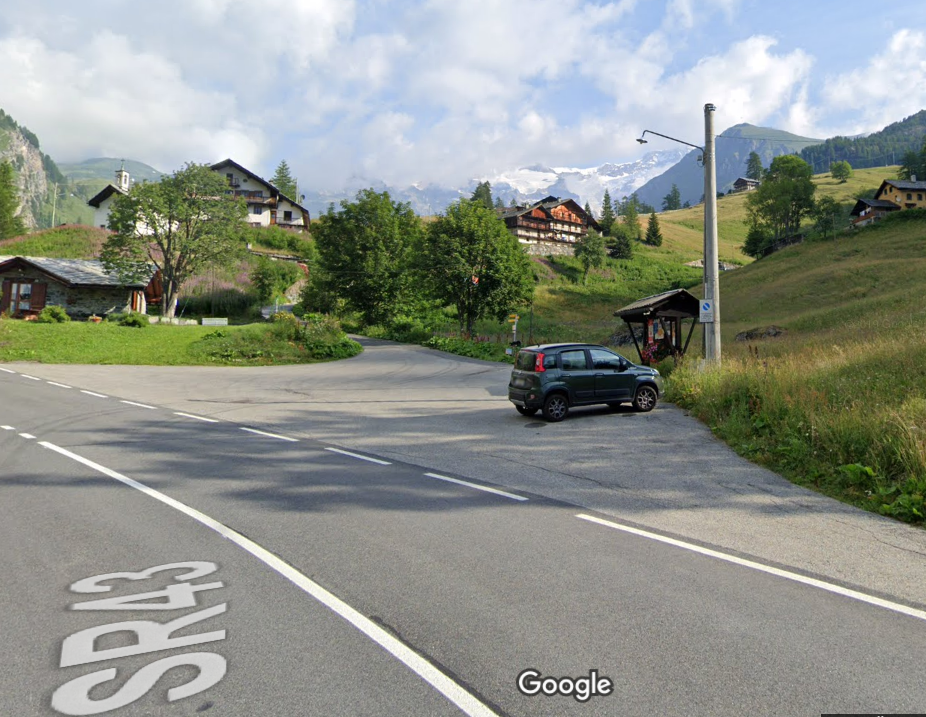
Trail 6 starts from Orsia (1772m) and arrives at Col D’Olen (2881m). It is 7273m long and the total positive elevation gain is 1159m.
The approximate time for the ascent is 3h31. The trail is rated of difficulty E.

Col d'Olen on a map in 1930

Col d’Olen on a map in 1930

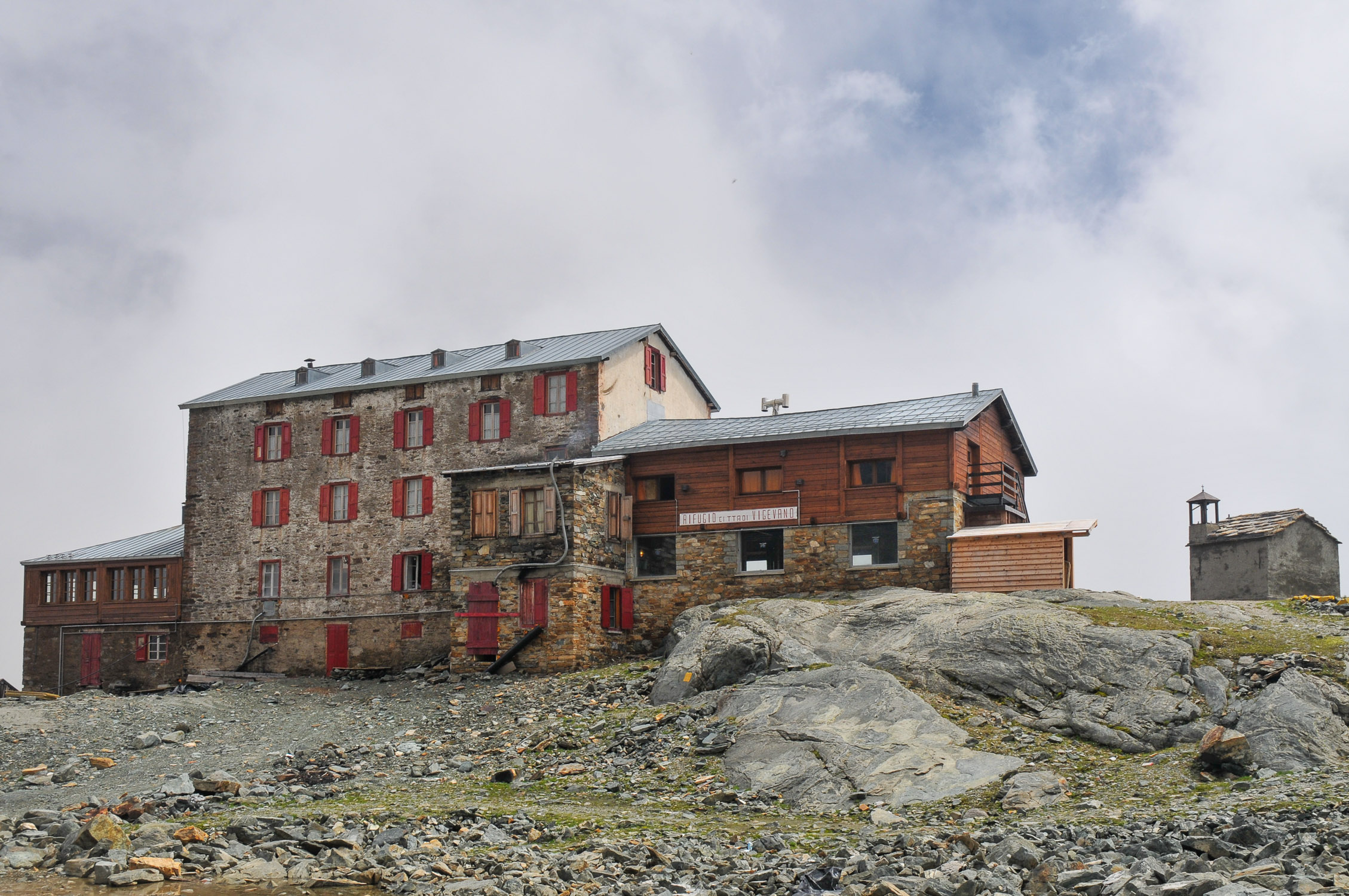
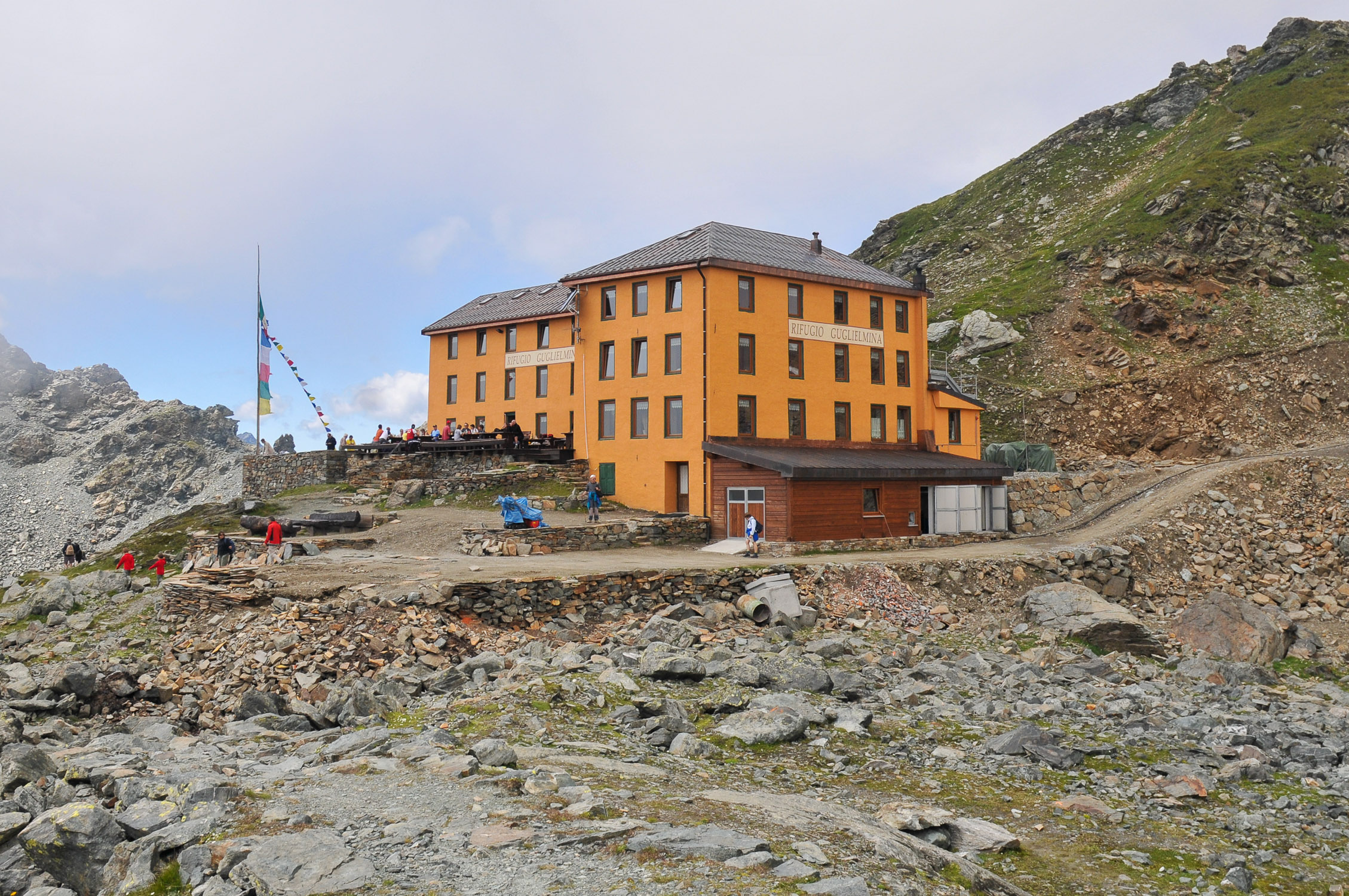
Trail 6 almost completely traces the old mule track that connected Gressoney La Trinité with Valsesia via Col d’Olen. Not surprisingly, three buildings of some historical significance are located in the immediate vicinity of the hill: theAngelo Mosso Scientific Institute, the City of Vigevano Shelter (closed since 2012) and the Guglielmina Shelter (burned in 2011).

It is a long and easy trail that has a “gastronomically” interesting feature: it passes in the vicinity of as many as 8 refuges, so you will certainly not have the problem of where to stop and eat–the one present at the Salati Pass is the Bar Restaurant Stolemberg, but if you want to stop earlier there are 7 alternatives, at different altitudes, shown below in the route description.

It is possible, once at Col d’Olen, to follow the trail on the Valsesian side that leads first to the Guglielmina, then to the Vigevano, and then to the Angelo Mosso Institute, climbing up to the nearby Passo dei Salati (2980m) from where you can return to the valley by rejoining the outward path, descending a few hundred meters following the path of the ski slope.

From Passo dei Salati it is possible to continue north to reach the Indren Glacier, thanks to Trail 6C.

I have never climbed so far along the first stretch, from Orsia to Gabiet: instead, I have walked the next stretch from Gabiet to the Passo dei Salati , 2931m (the pass following Col D’Olen) during the Covid lockdown of winter 2020 (to Gabiet I had climbed there starting from Stafal, along the path 7a).

1. Start and finish

Trail 6 starts from Orsia, the elevation is 1772m.
See on Google Maps.

Latitudine e longitudine (WGS84 - EPSG 4326): 45.8375510565, 7.81847400939

The arrival location is Col D’Olen. The altitude is 2881m.
See on Google Maps.

Latitudine e longitudine (WGS84 - EPSG 4326): 45.8704799167, 7.86874729084

Next to the start marker post is a small parking lot:

2. The route

Shortly after the start, you immediately go up the “Jolanda” ski slope path.

We first pass by the Morgenrot hut (1837m) and the Bedemie Bar (1900m), then climb up to the start of the Bedemie chairlift (closed in summer) and take a left, going up along the path of the Alpe Ricka ski slope.

We arrive in the Gabiet Lake area, where there are as many as five huts: Schéne Biel (2302m), Adler’s Nest (2323m) and Albergo Dal Ponte (2349m) along the trail, while Rifugio Gabiet (2370m) and Bar Ristoro Gabiet See (2385m) are not far away, near the shore of Gabiet Lake.

Trail 6 continues past Adler’s Nest and then Albergo Dal Ponte, climbing along the path of the Salati ski slope and then Salati 1,easily identified because they parallel the gondola pylons. The arrival station of the gondola is located at Passo dei Salati:Col D’Olen is the pass immediately above, as seen in the image below taken from Google Earth. Below the Salati Pass, a short distance from the arrival of the gondola, is the highest refuge: the Bar Restaurant Stolemberg (2957m).

1
2
3
4
5
1

The path goes up from here

2

Col d’Olen, 2880m

3

Chamois Horn/Gemschòre, 3026m

4

Salati pass, 2931m

5

Gabiet-Salati gondola lift arrival station, 2968m

In the vicinity of Col d’Olen on the Alagna side are several buildings of some historical significance.

Below the Salati Pass is the Angelo Mosso Scientific Institute, 2901m,research center opened in 1907 for which guided tours are organized during the summer months.

Angelo Mosso Scientific Institute

The City of Vigevano refuge, 2865m, opened in 1914, has been closed since 2012.

City of Vigevano Refuge

The Guglielmina hut, 2880m, a stupendous historic building, opened in 1978 and renovated in 1994, was unfortunately destroyed by fire in 2011 (sad video #1 and video #2), and it has been decided that it will never be rebuilt. I took this photo in 2008.

Wilhelmine Refuge

3. The GPX track

This is the map of the trail, according to the SCT Trail Cadastre of the Aosta Valley.

4. A recent hike

27/02/2021

I climbed up to the Salati Pass starting from Stafal on this winter day of lift closure due to the lockdown for Covid. Overcast day, with reddish sky due to the presence of Sahara sand masses carried by air currents. Few people crossed paths, all ski mountaineers who quickly passed us. Route done entirely on the groomed ski slope, thanks to crampons worn from start to finish.