Hiking trails of Gressoney
  • Choosing a trail
  • Hikes
    • Gressoney-Saint-Jean
    • Gressoney-La-Trinité
  • Trails
  • Refuges
    • Refuges description
    • Table of refuges
  • Weather
  • Lifts
  • Bus
  • Misc
    • Training for hiking
    • Tips for hikers
    • Information
    • Books on Gressoney
    • QR Codes
    • The Città di Mantova Refuge
    • Bivouacs of the past
    • The Castor tragedy of July 20, 1970
  • EN
    • IT
  • Click to open the search input field Click to open the search input field Search
  • Menu Menu
  • Link to Facebook
  • Link to Instagram
  • Link to Youtube
  • Description
  • Departure and arrival
  • The hike
  • GPX

Salza Pass (2882m), trail 6B

from Adler’s Nest to Salza Pass via Orestes Hut

The Salza Hill

The Salza Hill

Trail 6B starts from the Adler’s Nest and goes to the Salza Pass (2882m) via the Orestes Hutte. It is 4327m long and the total positive elevation gain is 539m.
The approximate time for the climb is 1h57. The trail is rated of difficulty E.

Arturo and Oreste Squinobal

Arturo and Oreste Squinobal

Salza Col can also be reached from Stafal, following trail 7C.

From the Salza Pass you can continue to Alta Luce (via trail 7c), or to the Città Di Mantova refuge (via trail 6A).

Trail 6B passes through the beautiful refuge Orestes Hütte, dedicated to the memory of Oreste Squinobal who, with his brother Arturo, formed a pair that constitutes the spearhead of Gressonese mountaineering accomplishing memorable feats in European and Himalayan mountains. I recommend that everyone read the Maria Teresa Cometto’s beautiful book, “Two Highlanders.”.

The shelter, in which it is possible to stay overnight, was built directly by the Squinobal family, and only vegan food is eaten there: read the appropriate in-depth page of the dedicated website to learn details about how environmentally sustainable the shelter is.

The trail does not present the slightest technical difficulty. Note that the Salza Pass can also be reached from the Gabiet by directly following trail 6A, which, however, does not pass through the Orestes Hut.

More information on level of difficulty, ascent times, maps and GPX tracks
Previous Previous Previous Next Next Next
123456789101112131415161718
Open image in lightbox: The marker at Adler's Nest Open image in lightbox: The marker at Adler's Nest
Open image in lightbox: From Adler's nest, looking toward the Del Ponte Hotel. Open image in lightbox: From Adler's nest, looking toward the Del Ponte Hotel.
Open image in lightbox: The bridge over the Endrebach stream from the top of trail 6A/6B Open image in lightbox: The bridge over the Endrebach stream from the top of trail 6A/6B
Open image in lightbox: Trail 6A/6B/7B near the dam Open image in lightbox: Trail 6A/6B/7B near the dam
Open image in lightbox: The dam as seen from the top of trail 7B, the trail comes to it from the right Open image in lightbox: The dam as seen from the top of trail 7B, the trail comes to it from the right
Open image in lightbox: The plateau next to the dam, above is a glimpse of the Orestes Hut Open image in lightbox: The plateau next to the dam, above is a glimpse of the Orestes Hut
Open image in lightbox: The Orestes Hütte Open image in lightbox: The Orestes Hütte
Open image in lightbox: The small bridge over the water reservoir behind the Orestes Hut rigugio Open image in lightbox: The small bridge over the water reservoir behind the Orestes Hut rigugio
Open image in lightbox: Walloon towards Indren Glacier, top right Stolemberg Open image in lightbox: Walloon towards Indren Glacier, top right Stolemberg
Open image in lightbox: The junction where trail 6B coming from the Orestes Hut rejoins trail 6A for a stretch Open image in lightbox: The junction where trail 6B coming from the Orestes Hut rejoins trail 6A for a stretch
Open image in lightbox: On the way up to the Salza Pass, the Orestes Hut is behind the mound in the center left Open image in lightbox: On the way up to the Salza Pass, the Orestes Hut is behind the mound in the center left
Open image in lightbox: Traverse up along the left flank, you can see the roof of the Orestes Hut Open image in lightbox: Traverse up along the left flank, you can see the roof of the Orestes Hut
Open image in lightbox: The marshy plateau, in summer filled with eriophores Open image in lightbox: The marshy plateau, in summer filled with eriophores
Open image in lightbox: Eriophores Open image in lightbox: Eriophores
Open image in lightbox: At this junction, trail 6B continues straight in the direction of the Salza pass, 6A continues to the right in the direction of the Mantua refuge Open image in lightbox: At this junction, trail 6B continues straight in the direction of the Salza pass, 6A continues to the right in the direction of the Mantua refuge
Open image in lightbox: Climbing up to the Salza Pass, the last climb. Open image in lightbox: Climbing up to the Salza Pass, the last climb.
Open image in lightbox: The Salza Hill Open image in lightbox: The Salza Hill
Open image in lightbox: From the Salza Pass toward the valley we have just traveled, over there is Stafal Open image in lightbox: From the Salza Pass toward the valley we have just traveled, over there is Stafal

1. Start and finish

Trail 6B officially starts from Adler’s Nest Shelter, the elevation is 2341m.
See on Google Maps.

Latitudine e longitudine (WGS84 - EPSG 4326): 45.8572184107, 7.84677011066

The arrival location is the Salza Hill . The altitude is 2880m.
See on Google Maps.

Latitudine e longitudine (WGS84 - EPSG 4326): 45.8787236898, 7.83818106107

2. The route

After parking in Stafal, take the Stafal-Gabiet gondola lift, which goes up to the right to Lake Gabiet(here for information on schedule and fares).

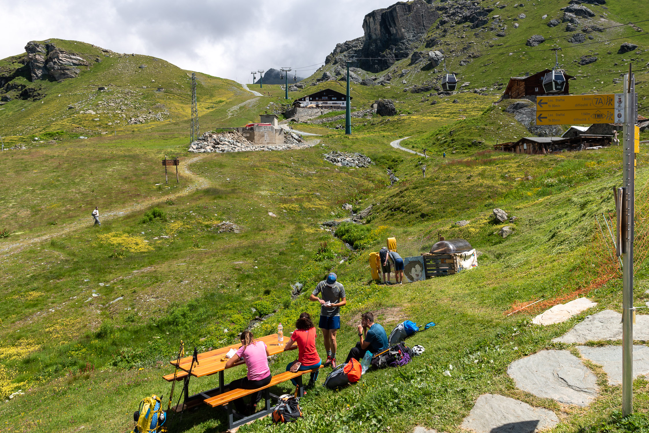
At Lake Gabiet, go up the dirt road for a very short distance until you reach Adler’s Nest (formerly Refuge du Lys): follow the signs for Trail 6A or 6B, two trails that are shared for a long stretch.

The marker at Adler's Nest

The marker at Adler’s Nest

Go up a few dozen meters along a marked dirt path until you reach below Albergo Del Ponte, where you take a left across the ski slope. Continue along a wide dirt road until you reach a nice little stone bridge that crosses the Endrebach stream .

The bridge over the Endrebach stream from the top of trail 6A/6B

The bridge over the Endrebach stream from the top of trail 6A/6B

Shortly after the bridge, the 6A/6B trail we are on is joined from the left by trail 7B, which climbs from Stafal. From here on, the trail is shared between 6A, 6B and 7B .

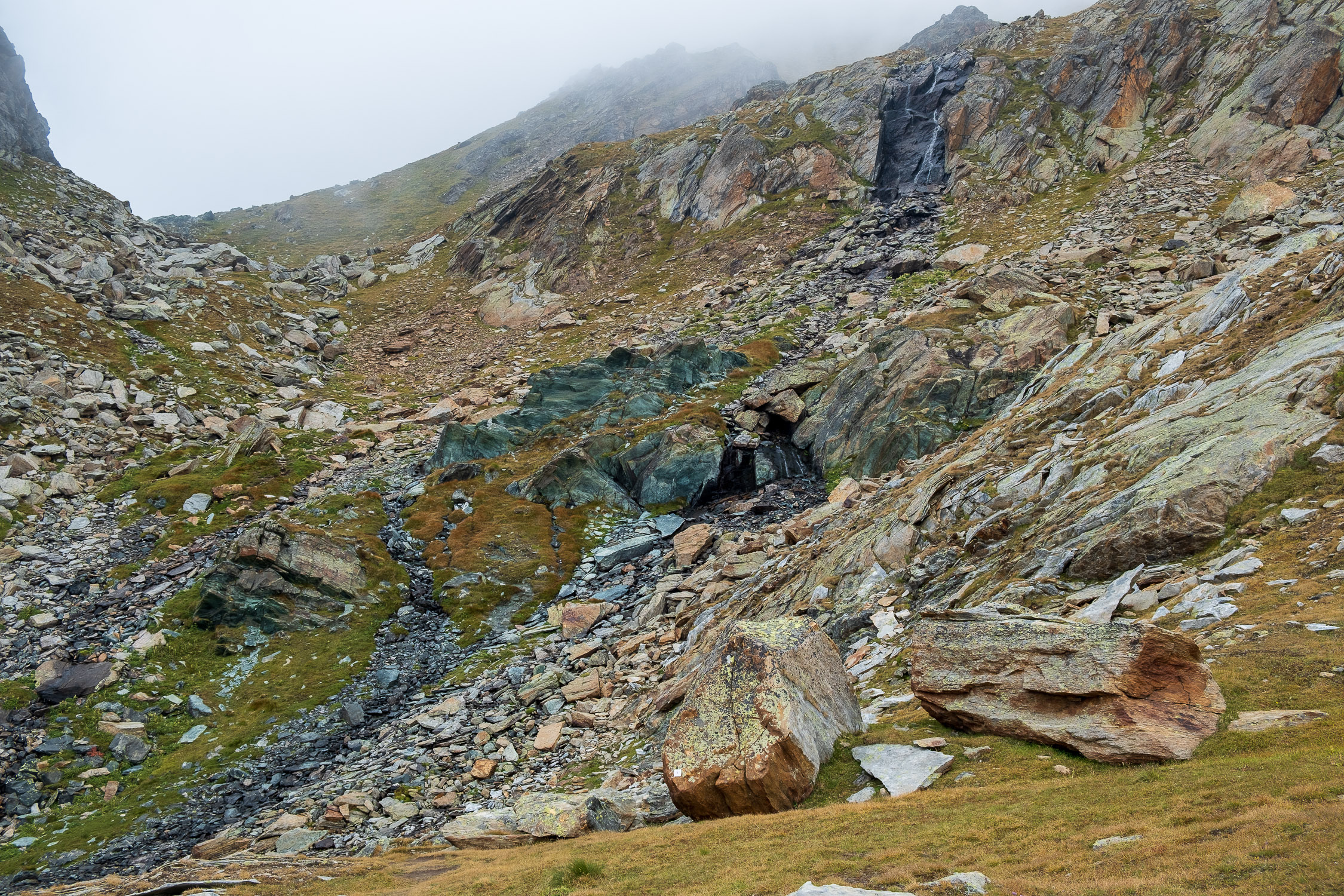
The trail passes a small rocky rise, and reaches a small dam at 2511m.

The dam as seen from the top of trail 7B, the trail comes to it from the right

The dam as seen from the top of trail 7B, the trail comes to it from the right

Before arriving near the dam there is a junction: on the left continue trails 6A (direct to Colle Salza and then to the Città di Mantova refuge) and 7B (direct to Blue Lake and Punta Telcio). To the right, however, continue along Trail 6B. Beyond the dam the path widens into a dirt road, crossing a plateau above which the Orestes Hut can be seen.

The plateau next to the dam, above is a glimpse of the Orestes Hut

The plateau next to the dam, above is a glimpse of the Orestes Hut

The photo above shows the relief along which the trail climbs. Past this step you finally reach the “Oreste’s hut” (2600m).

The Orestes Hütte

The Orestes Hütte

The trail continues by turning behind the hut to the right, passing over a small bridge that skirts a second water reservoir. After going around a wide curve to the left, the trail finally rejoins 6A at a new fork with trail markers.

The junction where trail 6B rejoins trail 6A for a stretch

The junction where trail 6B rejoins trail 6A for a stretch

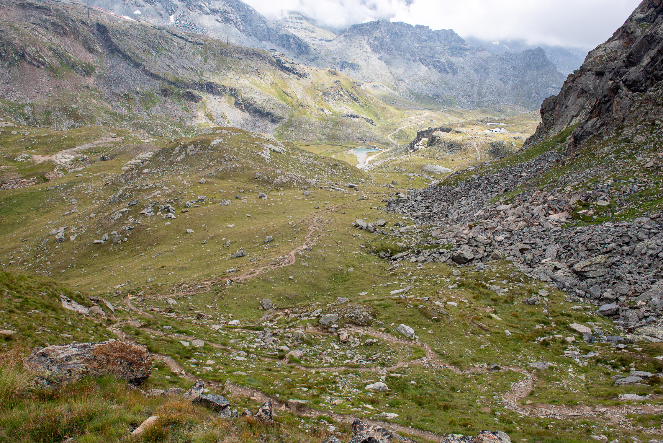
Continue uphill, skirting a wide esplanade on the left, furrowed by the thousands of rivulets flowing down from the Indren glacier, above which towers the Stolemberg (3190m).

Walloon towards Indren Glacier, top right Stolemberg

Walloon towards Indren Glacier, top right Stolemberg

The path ascends, passes along the left side of the slope…

It goes up traverse along the left flank

It goes up traverse along the left flank

… past a small marshy plateau that often in the summer is home to a veritable multitude of eriophorus…

Eriophores on the banks of the marsh.

Eriophores on the banks of the marsh.

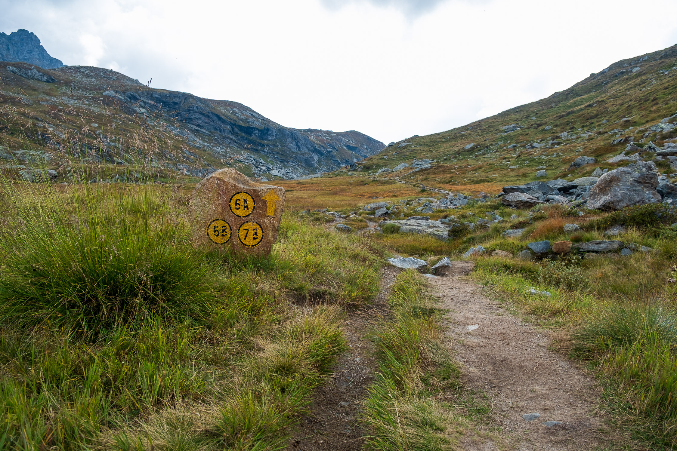
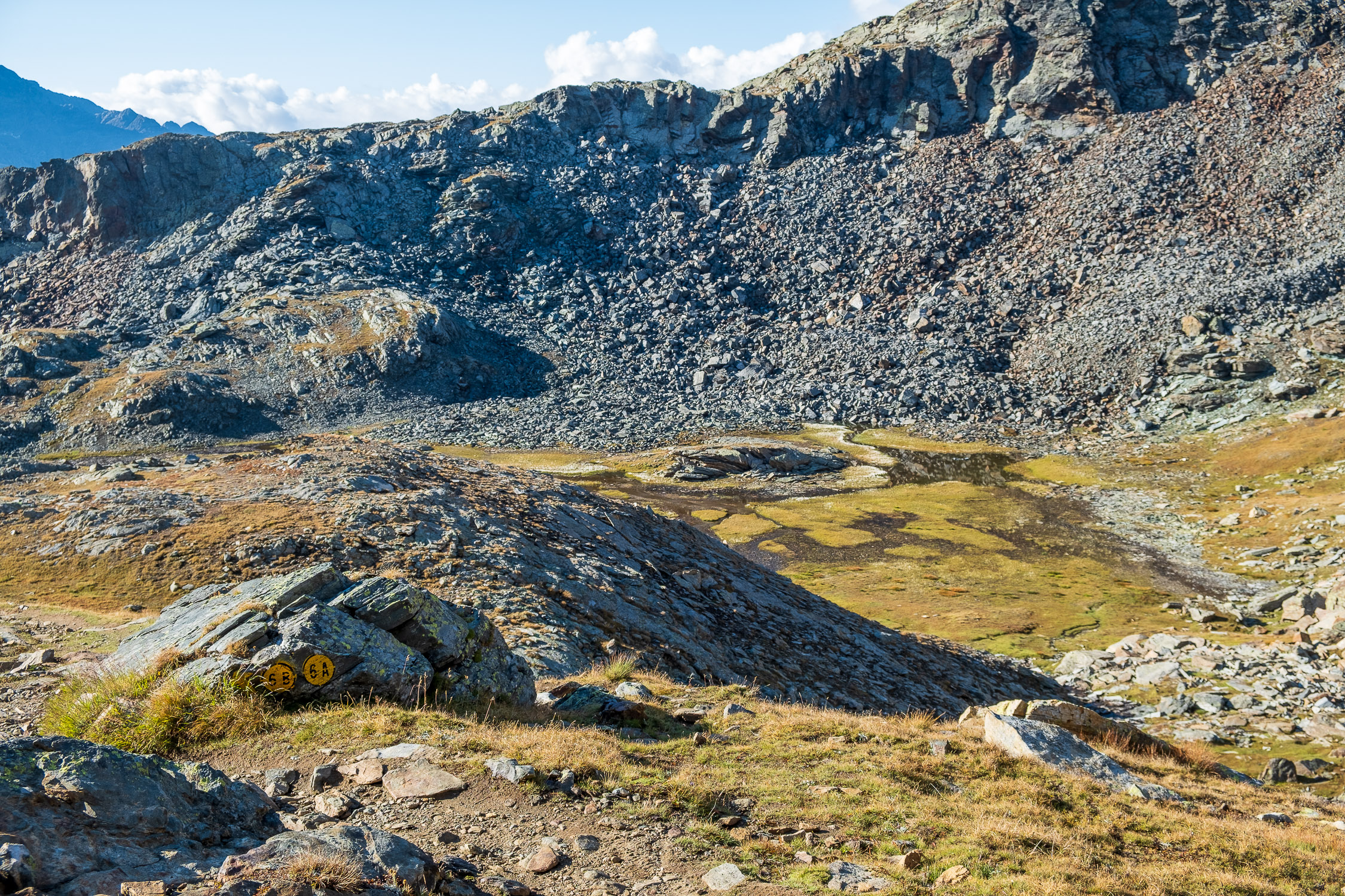
…and comes to a further junction with trail markers, at which trail 6A splits off and continues to the right, in the direction of the Città di Mantova refuge. Instead, 6B proceeds straight ahead, toward the Salza pass: in the photo below, the pass is up there where you can see the sky.

At this junction, trail 6B continues straight in the direction of Salza Hill, trail 6A continues to the right in the direction of Mantua refuge

At this junction, trail 6B continues straight in the direction of Salza Hill, trail 6A continues to the right in the direction of Mantua refuge

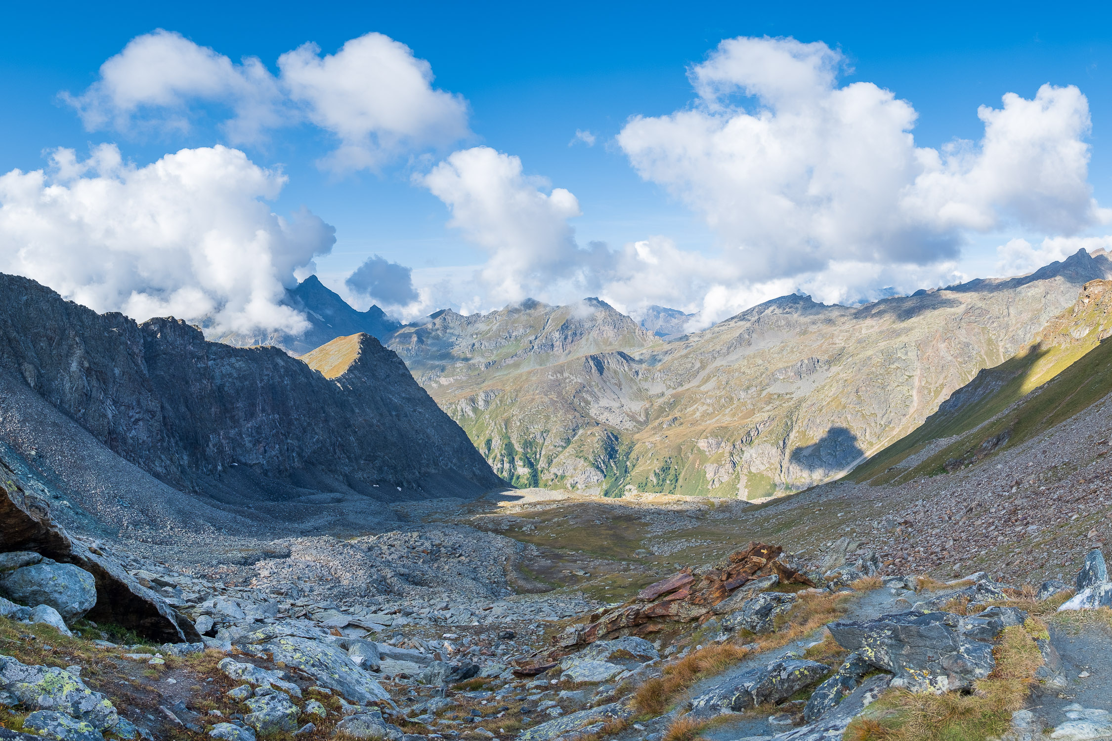
This is the last climb, along a very stony slope furrowed by several rivulets of water, which softens at the end and leads to Colle Salza(2882m).

The Salza Hill

The Salza Hill

Below is a 3d aerial view, in which the highlights of the last part of the route are highlighted.

1
2
3
4
5
6
7
8
9
1

Trail 6B comes from this direction

2

The dam, just before which is the junction with trail 7B leading to Blue Lake and Punta Telcio

3

Trail 6B climbs in this direction

4

The Horestes Hut

5

Trail 6B ascends in this direction

6

The marshy plateau, usually filled with eriophores

7

The Salza Hill

8

The Blue Lake

9

Punta Telcio

3. The GPX track

This is the official route of the trail, according to the SCT Trail Cadastre of the Aosta Valley.

Download the trail in GPX format

4. A recent hike

24/08/2020

I do not pass by the Orestes Hut very often, because I normally go to the Salza Pass directly via 6A.

That day I passed by this refuge on my way back from Alta Luce.

Paths traveled:

  1. I climbed from Gabiet directly up to Colle Salza via trail 6A (although actually the last piece, from the last 6A/6B junction to Colle Salza, is technically trail 6B since at the junction 6A, which does not reach Colle Salza, veers to the right to the Mantova refuge)
  2. From the Salza Pass to Alta Luce, I rode the 7C trail (click here for more information)
  3. on the return from the Salza Pass I went back to Gabiet following trail 6B (and thus passing this time through the refuge)

It was a rather cloudy day (so much so that at High Light I could hardly see the glacier below), a day that then got even worse in the afternoon. I could not enter the shelter because, during Covid period, the entrance was reserved only for those who had made reservations.

I realize, looking at the path below that after junction 6A/6B, going to the hut, I did not follow the path perfectly. I must have pointed directly toward the refuge, cutting along the wide meadow.

Share this page
  • Share on Facebook
  • Share on X
  • Share on LinkedIn
  • Share by Mail
2022 - Gressoney Hikes - info@gressoneyhikes.com - privacy policy - sitemap
Link to: Mantova (3455m) and Gnifetti (3647m) refuges, trail 6A Link to: Mantova (3455m) and Gnifetti (3647m) refuges, trail 6A Mantova (3455m) and Gnifetti (3647m) refuges, trail 6AThe last few meters before the arrival at the Mantua refuge. Link to: Indren Glacier (3288m), trail 6C Link to: Indren Glacier (3288m), trail 6C Indren Glacier (3288m), trail 6C
Scroll to top Scroll to top Scroll to top

This site uses cookies to ensure functionality and improve the user experience. You can accept with "Accept", decline with "Decline" or deny consent to certain cookies in "Settings". For more information, see the privacy policy


AcceptDeclineSettings

Cookie and Privacy Settings


How we use cookies

We may request cookies to be set on your device. We use cookies to let us know when you visit our websites, how you interact with us, to enrich your user experience, and to customize your relationship with our website.

Click on the different category headings to find out more. You can also change some of your preferences. Note that blocking some types of cookies may impact your experience on our websites and the services we are able to offer.

Essential Website Cookies

These cookies are strictly necessary to provide you with services available through our website and to use some of its features.

Because these cookies are strictly necessary to deliver the website, refusing them will have impact how our site functions. You always can block or delete cookies by changing your browser settings and force blocking all cookies on this website. But this will always prompt you to accept/refuse cookies when revisiting our site.

We fully respect if you want to refuse cookies but to avoid asking you again and again kindly allow us to store a cookie for that. You are free to opt out any time or opt in for other cookies to get a better experience. If you refuse cookies we will remove all set cookies in our domain.

We provide you with a list of stored cookies on your computer in our domain so you can check what we stored. Due to security reasons we are not able to show or modify cookies from other domains. You can check these in your browser security settings.

Google Analytics Cookies

These cookies collect information that is used either in aggregate form to help us understand how our website is being used or how effective our marketing campaigns are, or to help us customize our website and application for you in order to enhance your experience.

If you do not want that we track your visit to our site you can disable tracking in your browser here:

Other external services

We also use different external services like Google Webfonts, Google Maps, and external Video providers. Since these providers may collect personal data like your IP address we allow you to block them here. Please be aware that this might heavily reduce the functionality and appearance of our site. Changes will take effect once you reload the page.

Google Webfont Settings:

Google Map Settings:

Google reCaptcha Settings:

Vimeo and Youtube video embeds:

Other cookies

The following cookies are also needed - You can choose if you want to allow them:

Privacy Policy

You can read about our cookies and privacy settings in detail on our Privacy Policy Page.

AcceptDecline
Open Message Bar Open Message Bar Open Message Bar